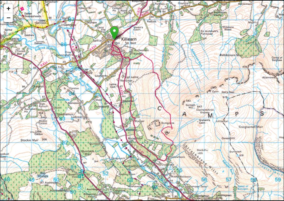
Dumfoyn from Killearn(426m)
Saturday 17th January 2026
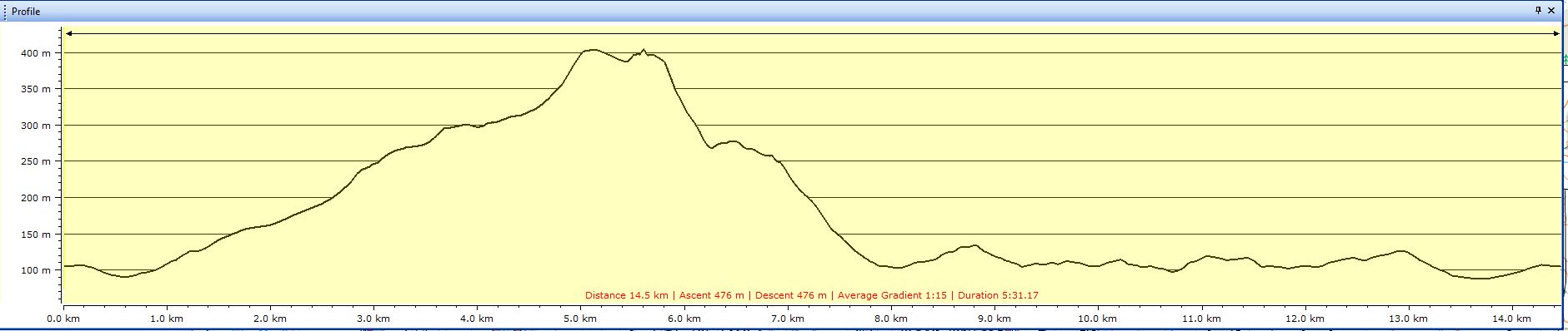
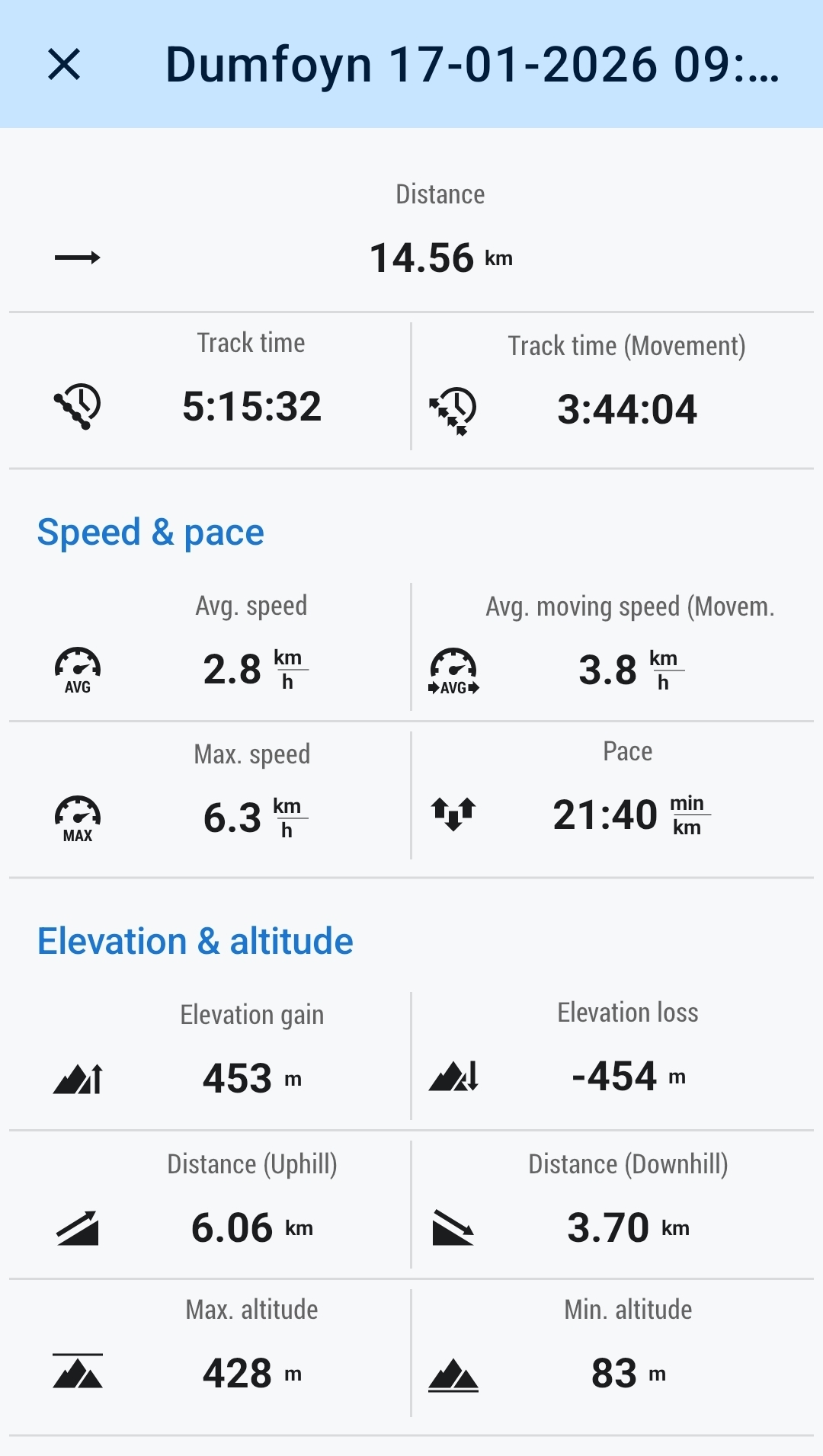
15kms
5hrs
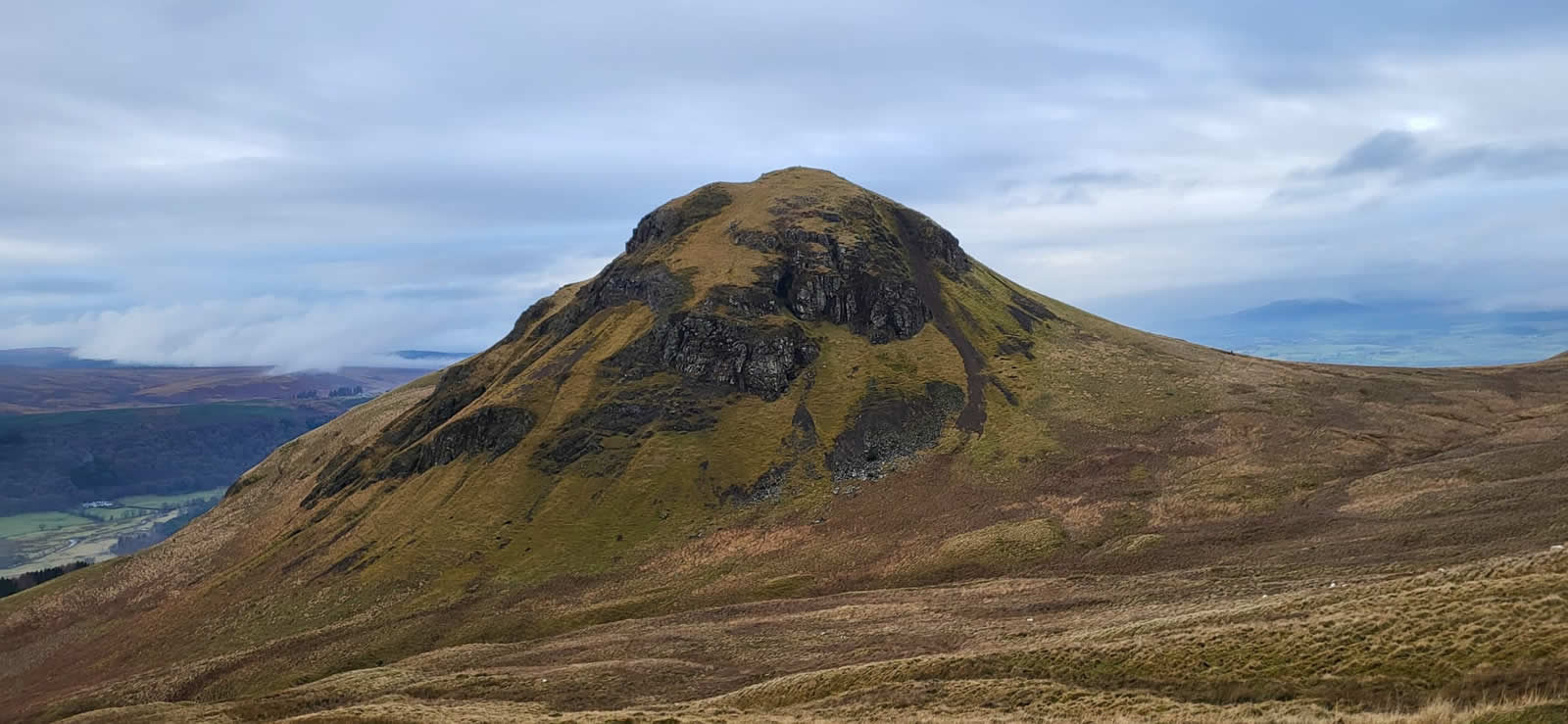
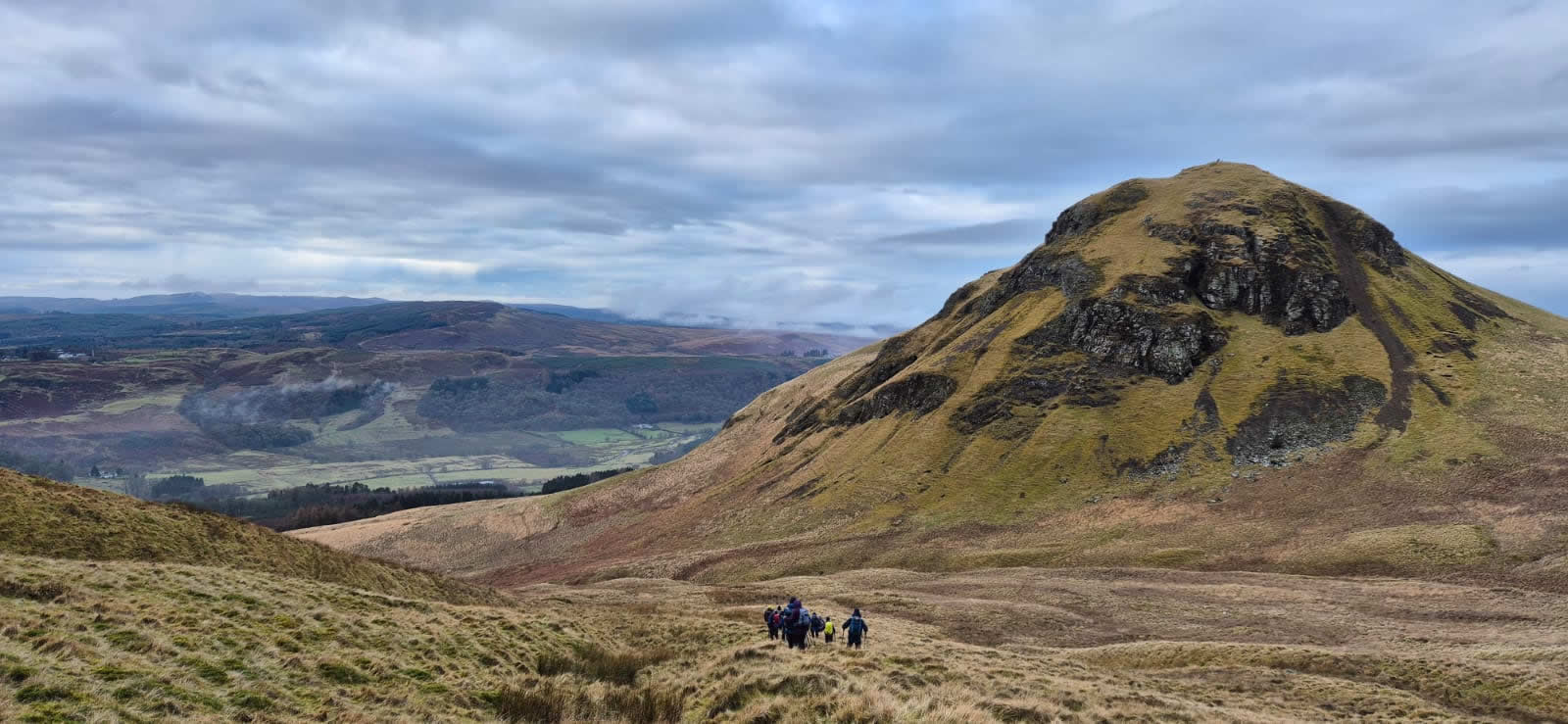
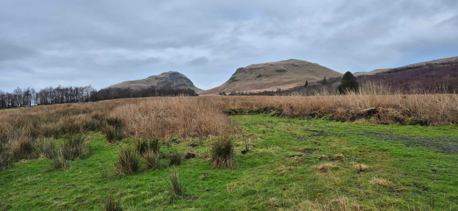
Although not the highest point in the Campsie Fells, Dumgoyne is probably the most recognisable and visited top, its conical form in complete contrast to the generally flat, grassy hills that make up the Campsie Fells. However, this most recognisable and prominent feature was not our target for today, we were headed a mere 600 metres east south east of Dumgoyne to it’s little sister, Dumfoyn, at 426m high and a mere 1 metre lower than Dumgoyne this is a much less frequented hilltop which offers an outlook and different aspect of Dumgoyne that goes unseen from the regular approach paths to Dumgoyne.
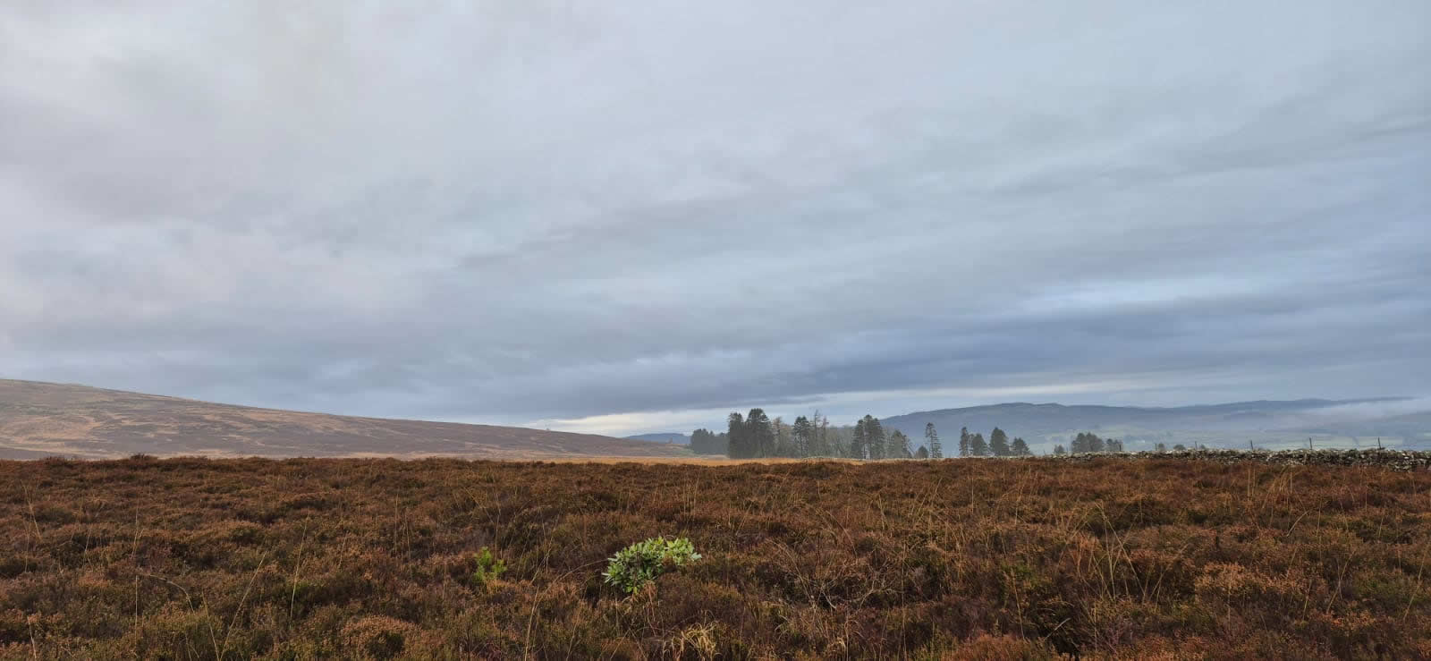
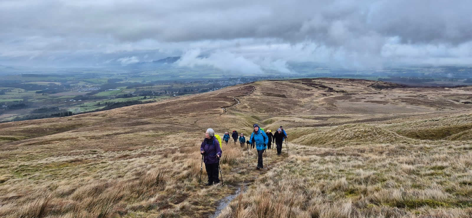
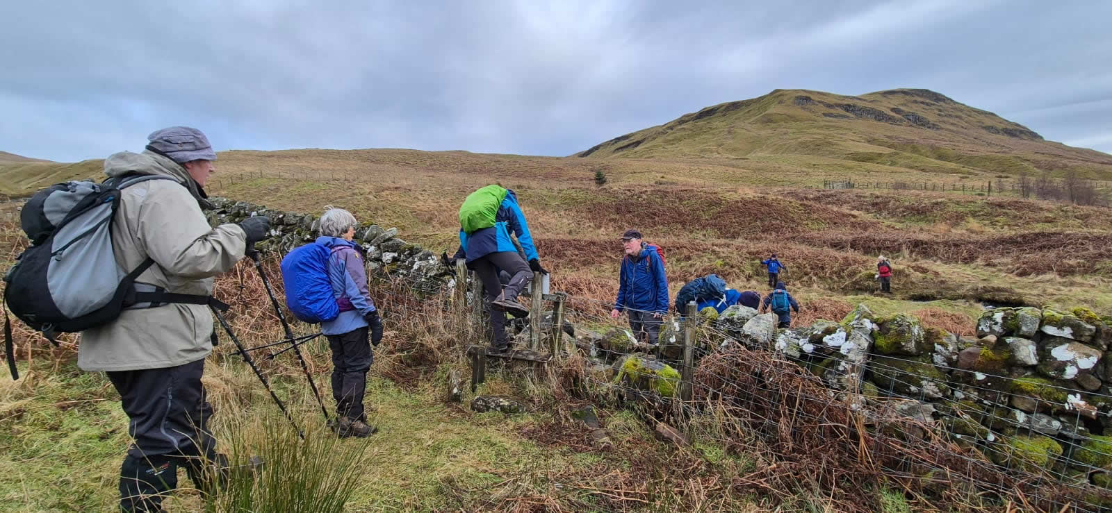
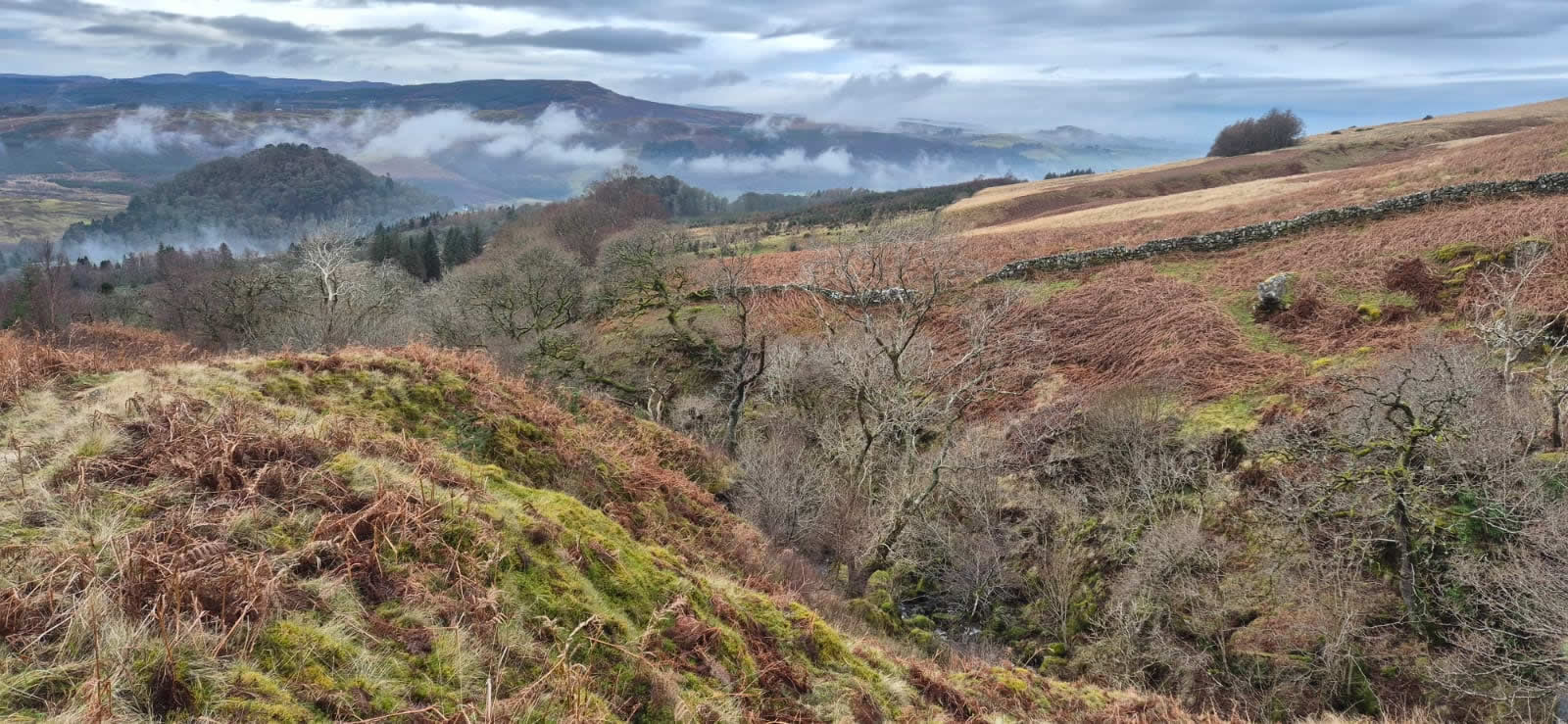
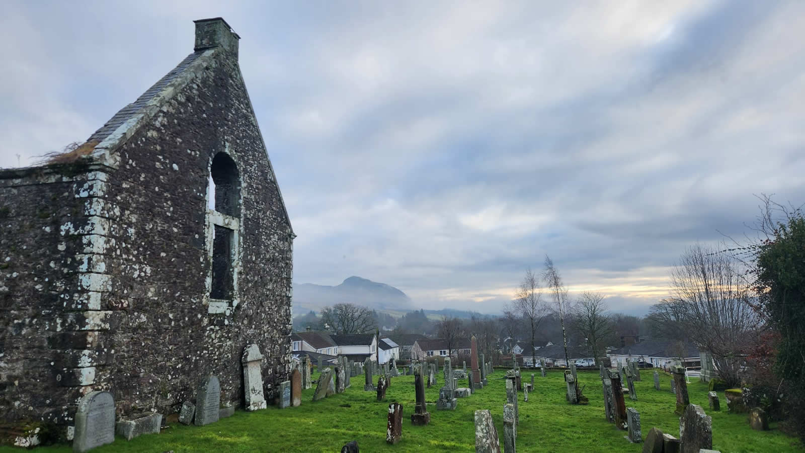
Leaving Killearn and walking through Kirkhouse Wood we ignored the right turn onto the main pipeline track and continued through the woodland alongside the boundary wall to the eastern edge of the woods to exit the woods onto the open moorland where the winter heather looked dark, almost black as it blanketed this stretch of moorland over which the narrowest of tracks, no more than a sheep-track, crossed the moorland to join up with the broader hillside path a kilometre or so away. We had left Killearn in a slight drizzle, but as we joined the hillside track and paused for a moment, confidence was growing in better weather ahead as was evidenced by the number of people discarding waterproof layers in anticipation of drier weather ahead.
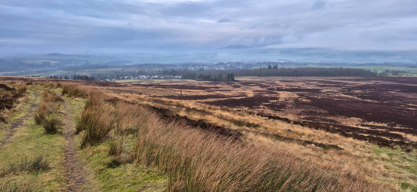
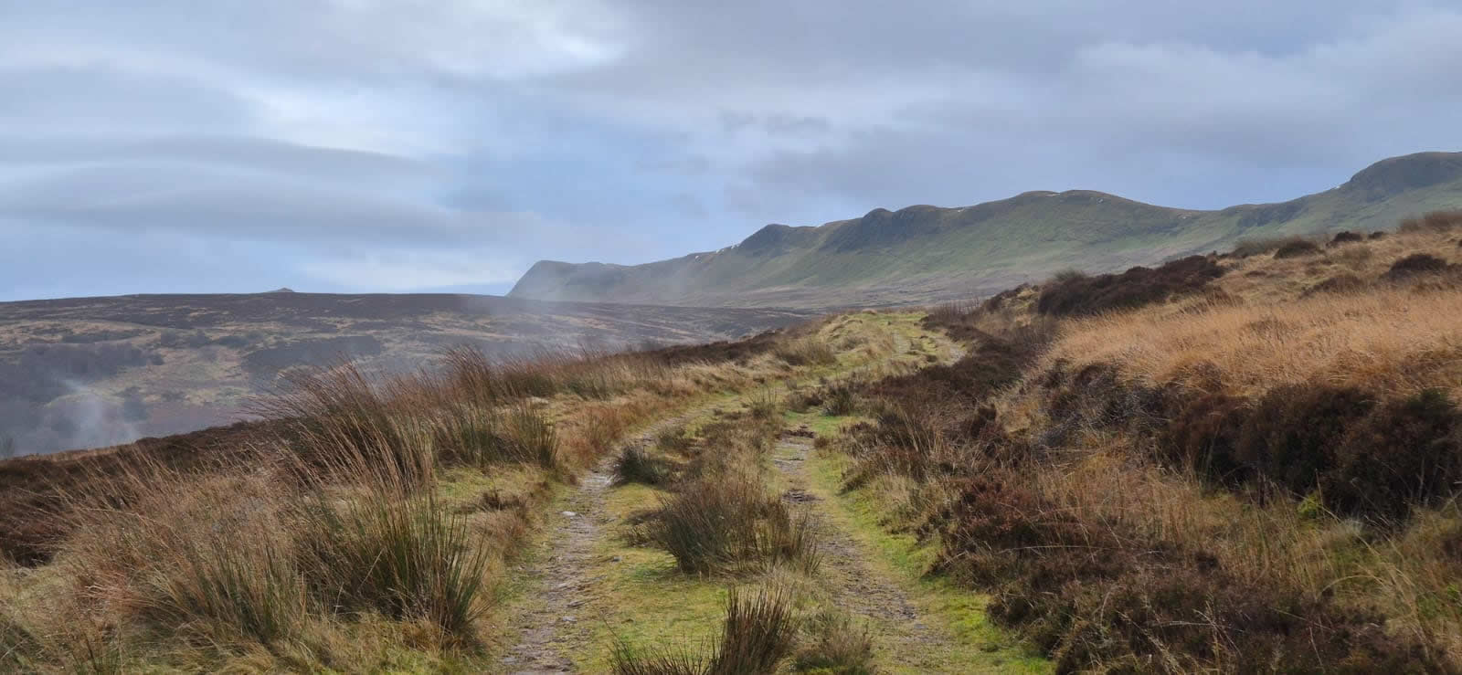
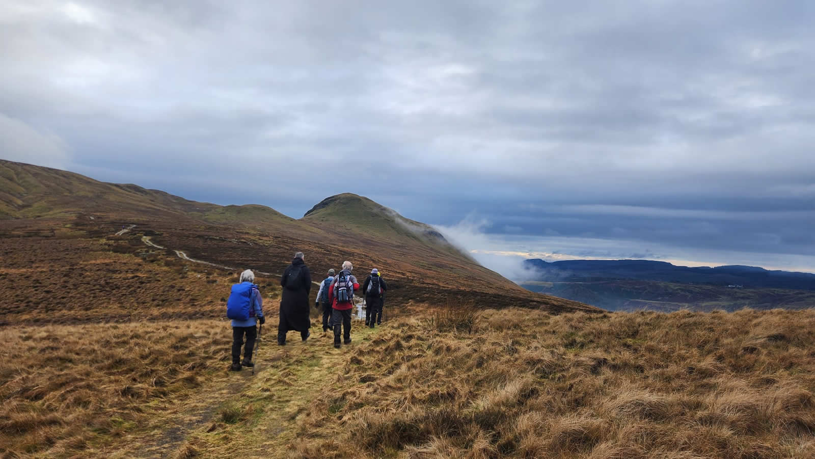
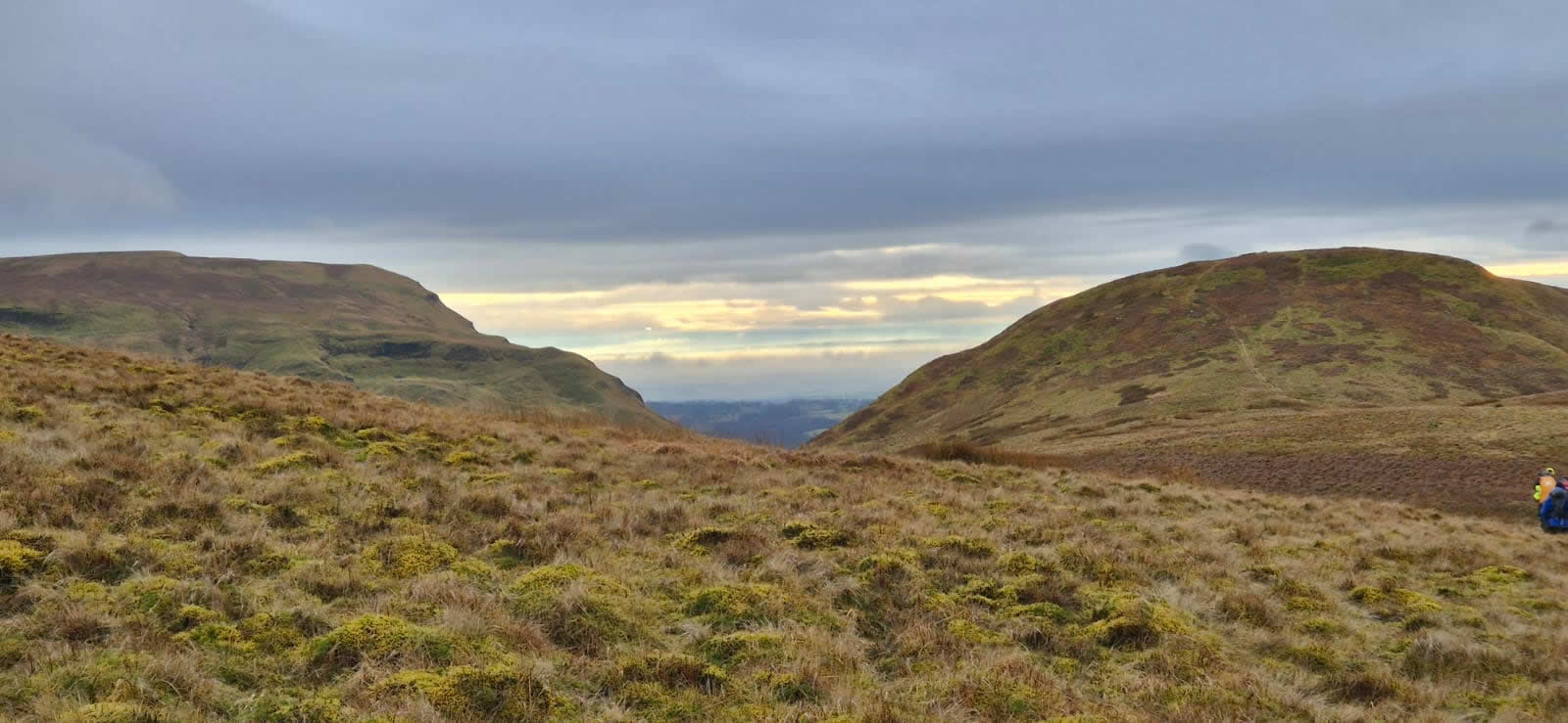
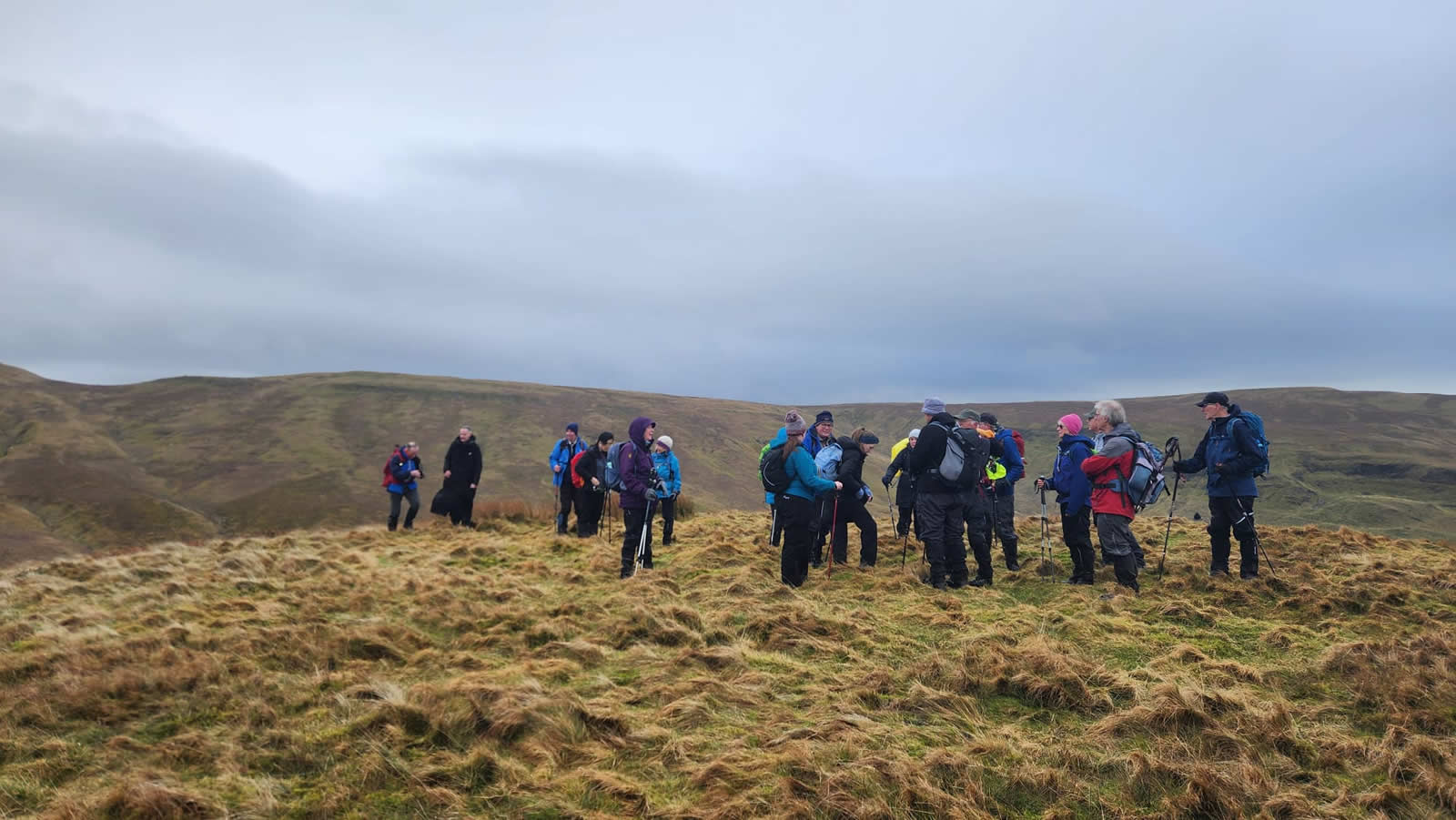
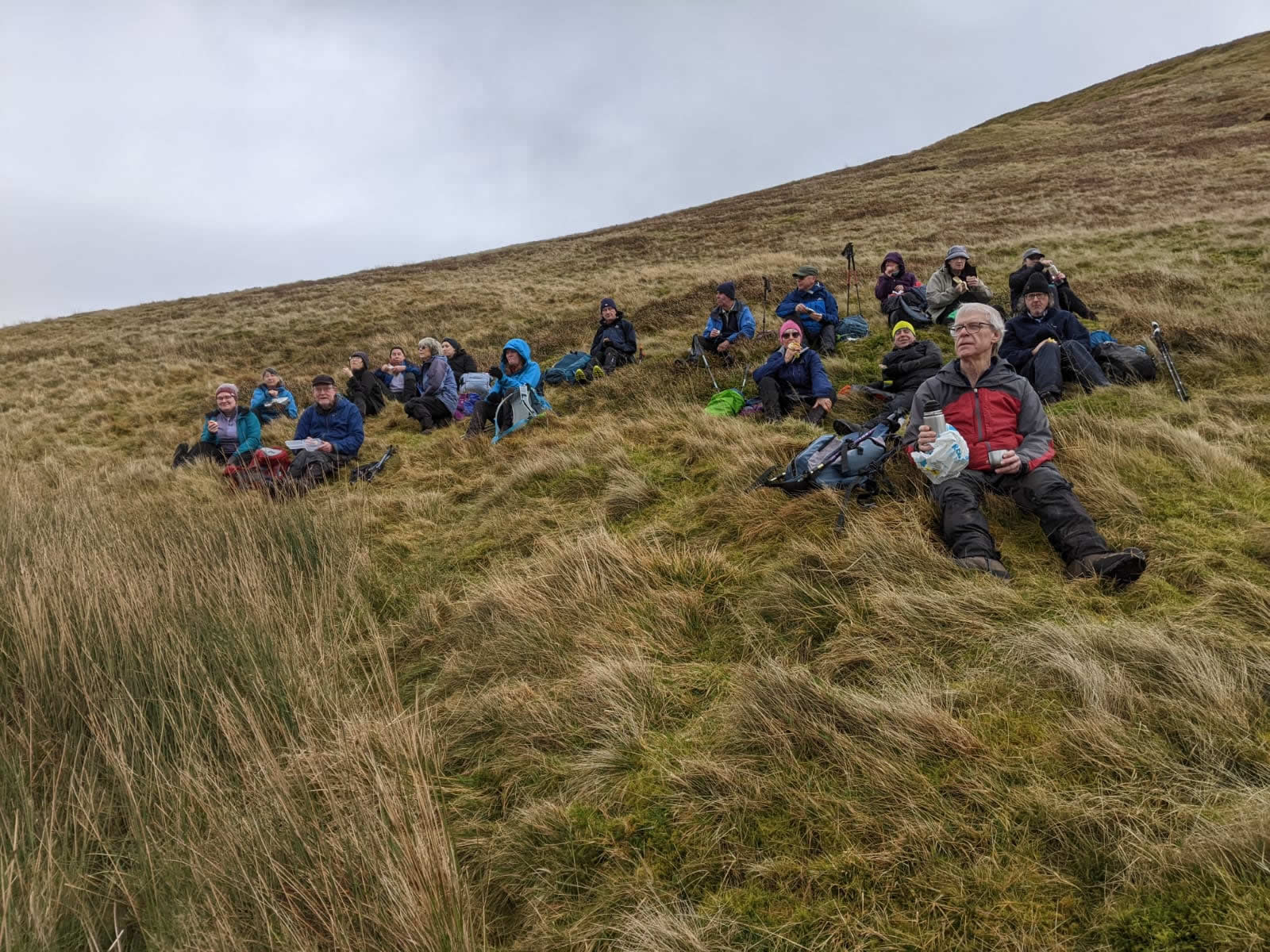
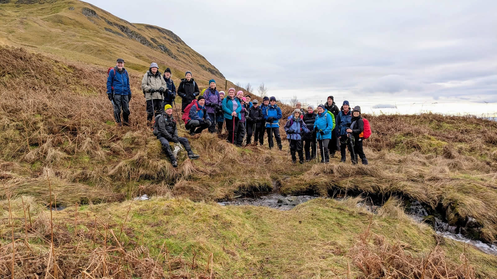
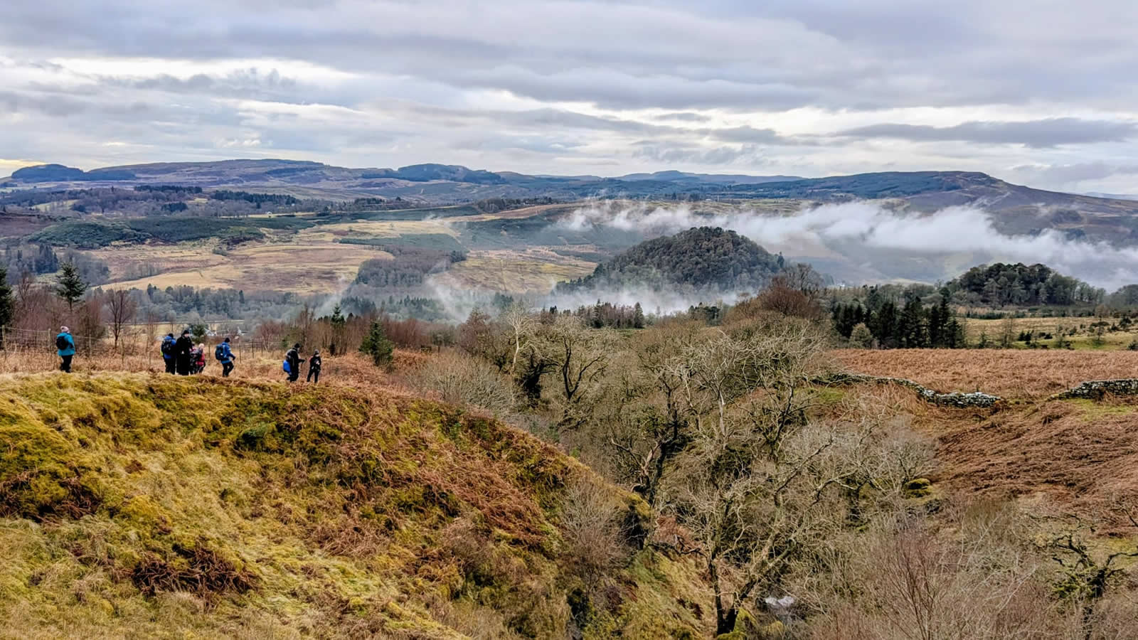
The hillside track is a joy to walk, a broad, grassy track, a little wet in places, but nevertheless a fine track that offers lovely views of the ridge along Ballagan Tops and the ever present Dumgoyne, which looks deceptively close, but the track takes a rather winding approach until it reaches the 400m height, at which point it has wound around to the north side of Dumgoyne, at which point Dumfoyn now comes into view, sitting a little behind and beyond Dumgoyne it’s lesser visited status being emphasised by the fact that as you branch off from the main track you take a much fainter, less trodden track through the grass and onto the final, short climb to the unmarked summit, not even a single stone or cairn to mark the 426m top. The weather had in fact remained dry, but on the exposed summit there was quite a chill in the slight breeze, and so we dropped off the to and descended a short distance to the west side of the top where we found an area of deep, comfortable grass, out of the breeze to sit and take a short lunch break overlooking the impressive southern crags on Dumgoyne.
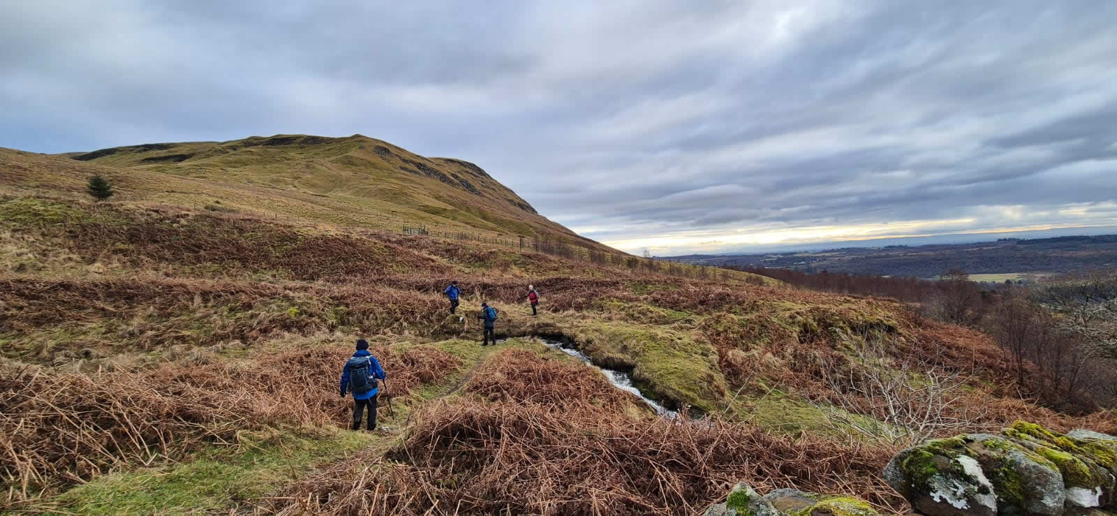
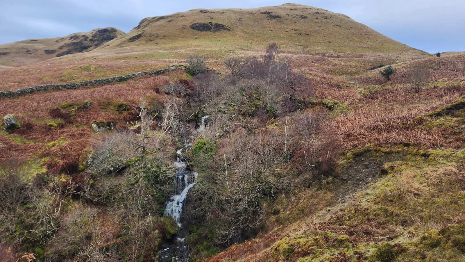
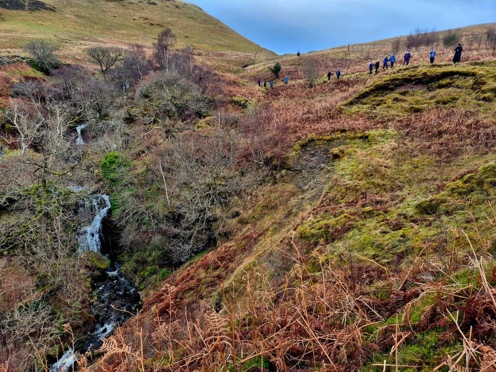
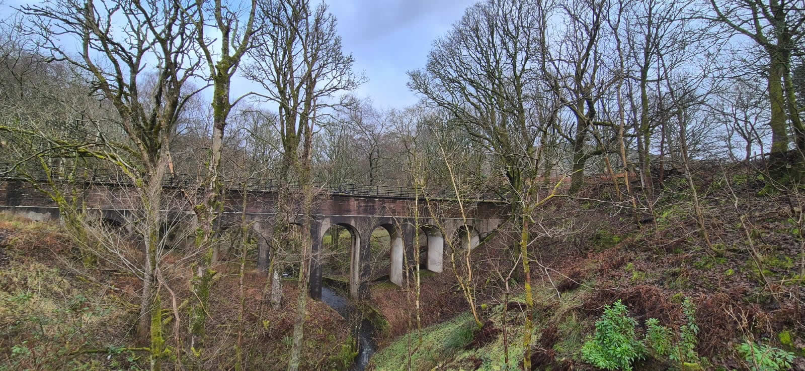
Refreshed and fit for the off, we descended the grassy, pathless hillside between Dumgoyne and Dumfoyn contouring southeast below Dumfoyn to pick up yet another narrow track leading to the un-named burn in Cauldhame Glen, across which we linked up with the track down the east side of the burn, passing an impressive waterfall enroute as we made our way downhill on what was probable the most awkward section of the whole route. Awkward in that the ground underfoot was short, wet grass on a bed of mud which required a little concentration to avoid any sudden mishaps which would leave one scrabbling around in a muddy bath. We emerged from the glen onto the “pipeline” track above Craigbrock for what was then a simple leg stretch back along the course of the pipeline to Killearn.
An excellent day, good weather, fine company and a great little hill. Thanks David.
Photo Gallery
Click the buttons to select photo size.