Garadbhan Forest and Conic Hill(361m)
Saturday 3rd January 2026
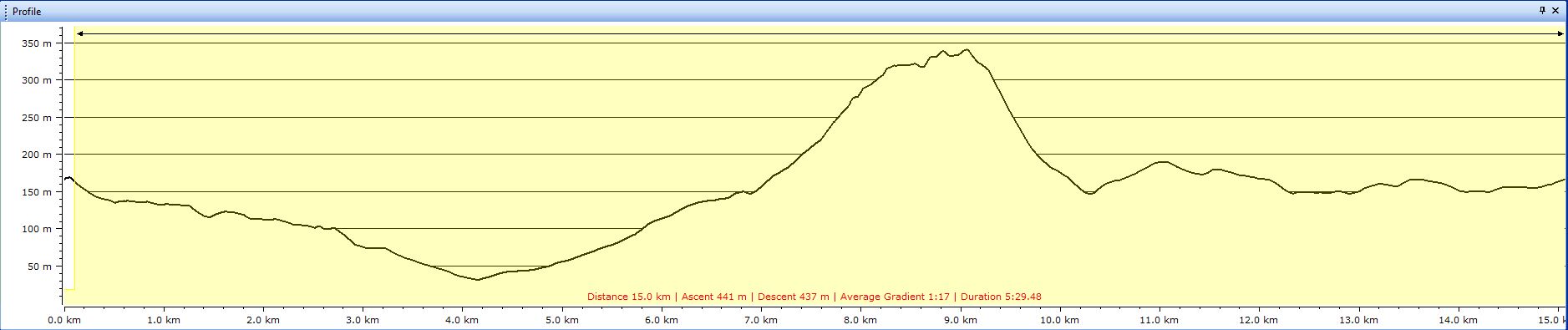
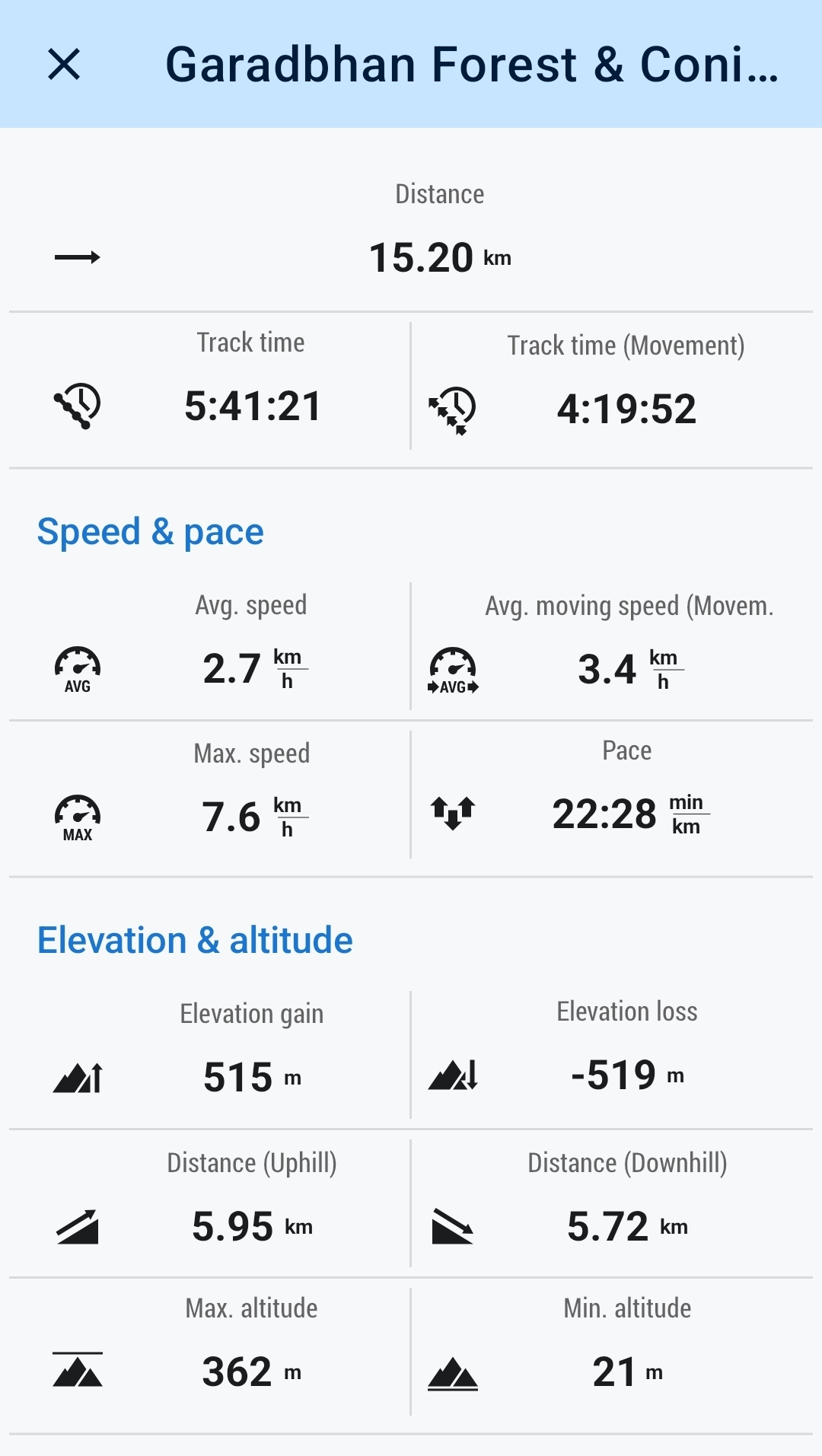
15kms
5hrs 30mins
Sitting to write this report for my first walk of 2026, I realise that the final month of 2025 looks to be a month without a walk, which is not quite correct. In fact I had two excellent walks, a 14km Killearn to Dumfoyn gap and return via the pipeline track, and a 14km round of the Yankee Road with Mike and Ian, I just never got round to creating reports for these two walks, so this short paragraph will at least acknowledge the effort of completing these two “leg stretchers”.
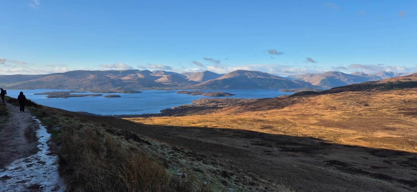
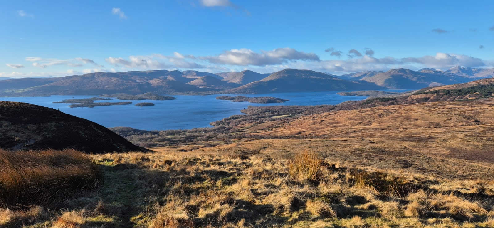
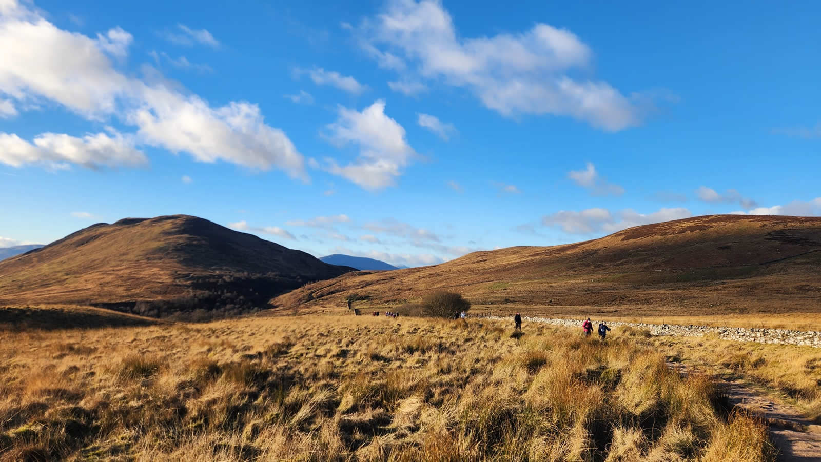
And so to 2026 the first few days of which have seen us bathed in glorious winter sunshine and crisp frosty mornings, just perfect winter walking conditions. All the incentives needed for a fine walk through Garadbhan Forest and a steady ascent of Conic Hill for some wonderful views over Loch Lomond; what better way to start off the years walking calendar.
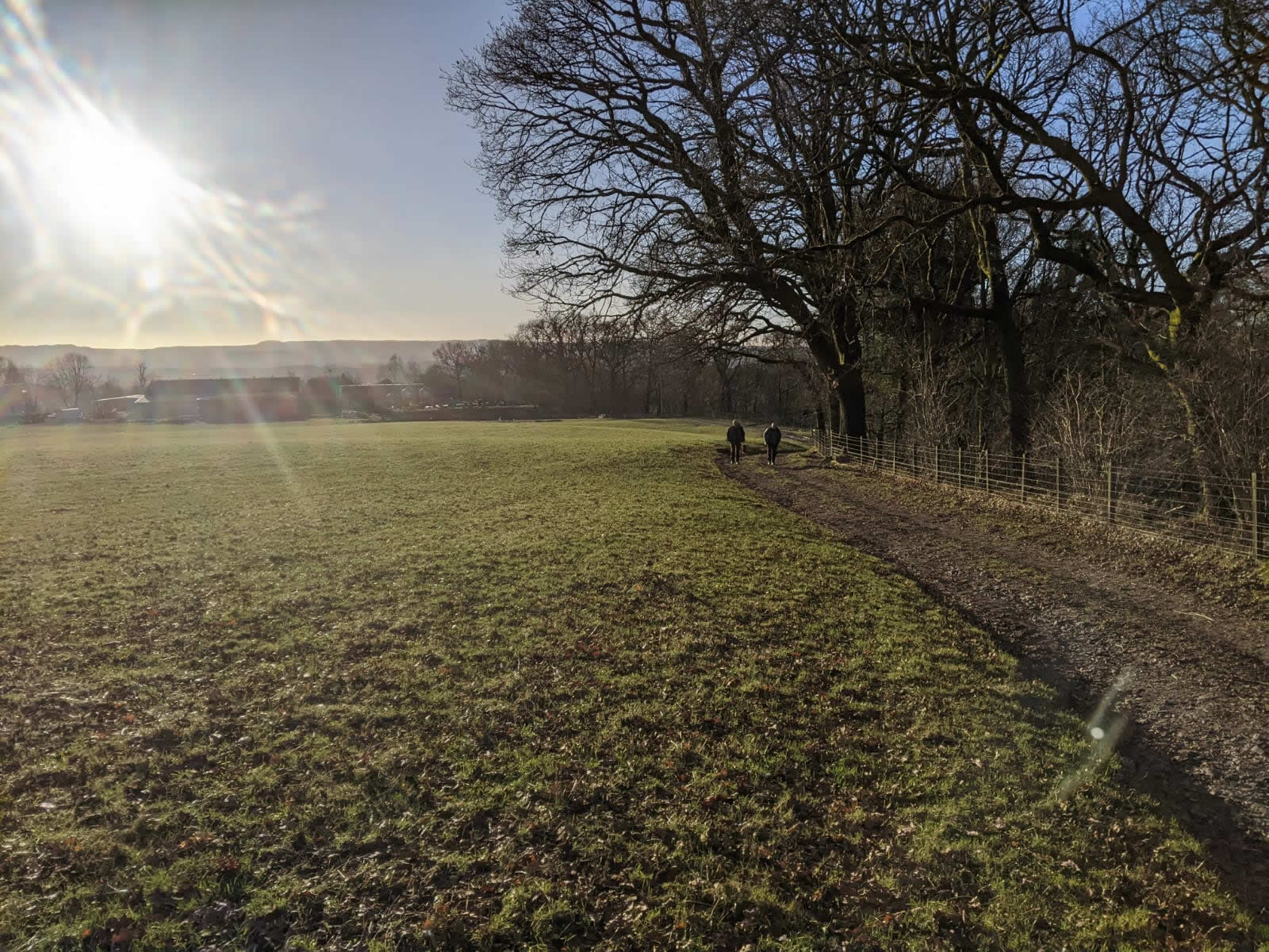
Ignoring the main forest track leading into and through the centre of Garadbhan Forest, we initially walked a short distance down the narrow road leading back towards Drymen to the edge of the forest and then turned onto the minor track which skirts the southern boundary of the forest and followed it as it wound its way generally westwards for just over three kilometres, the initial forest track changing to a narrow, and at times overgrown path through bush and scrub until it finally exits into the rough pasturelands of Creityhall Farm and the track downhill to Milton of Buchanan. A bonus of the cold, dry frosty nights we have had of late was that this lower path, which on previous use had been rather wet and boggy underfoot, especially through the scrub, was today very firm underfoot as the ground was frozen hard and fine for walking along.
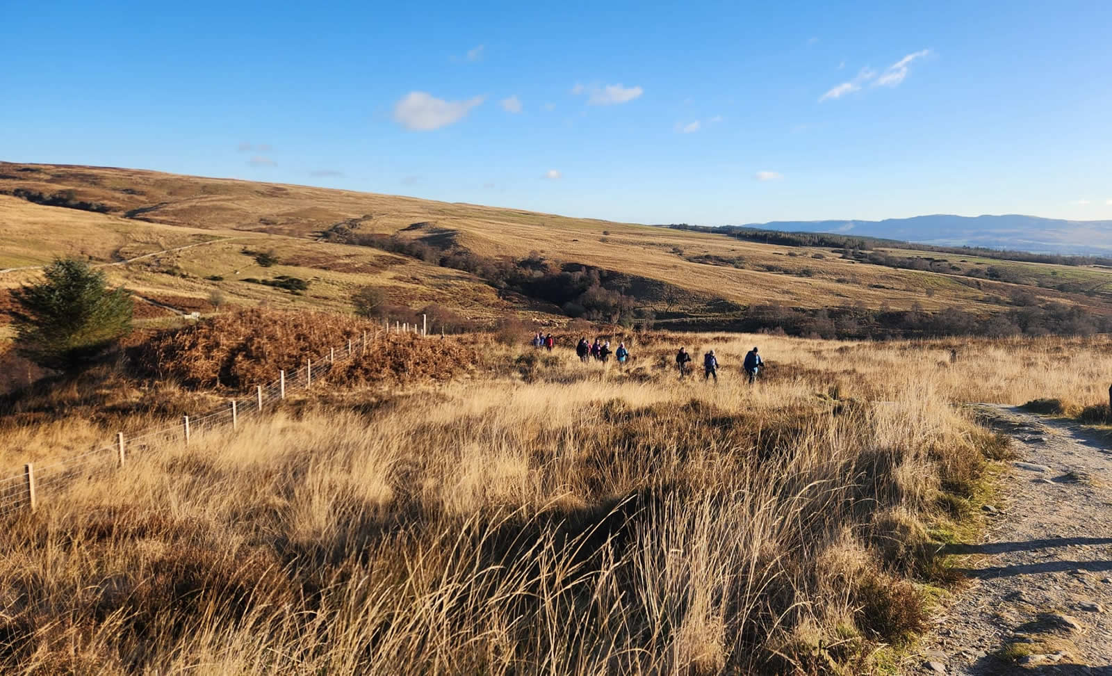
A short walk through Milton of Buchanan and we turned onto the farm track leading to Gartincaber Farm where there was a slight delay as we had to wait for the very accommodating farmer to herd a few stray cows back into a large barn to rejoin the rest of the herd and clear the way through the fenced-off barn area through which we had to pass to gain the upper pastures along the east side of the Burn of Mar for a very steady climb through beautiful fields and open hillside to join up with the West Highland Way at the bridge spanning the gorge over the Burn of Mar, an excellent spot for a short break to fuel up for the final steady pull up to the summit of Conic Hill.
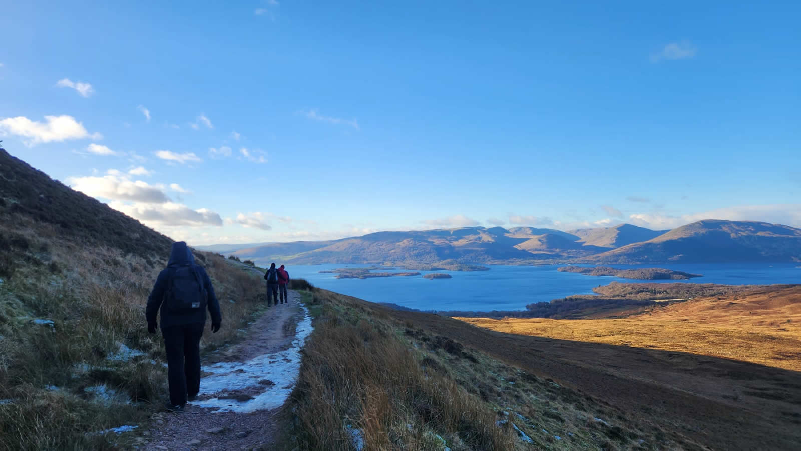
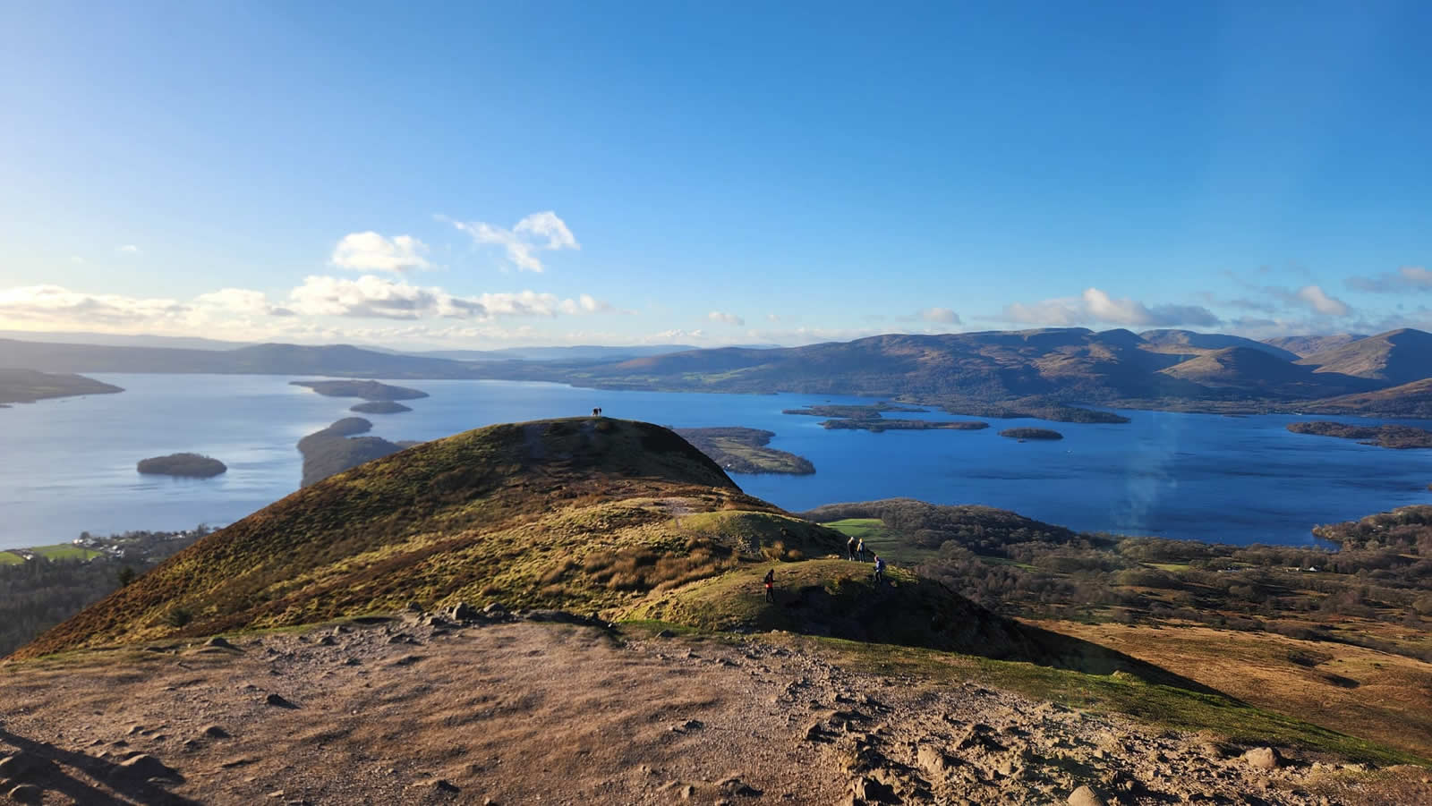
Now on the West Highland Way we climbed the rough and rocky path leading from Burn of Mar and contouring around the northern edge of Conic Hill, a climb that required a little concentration as there was quite a covering of ice which had formed over the numerous pools of water along the path, any of which would send you skidding if wrongly footed as they were bypassed. Atop the path, I was quite impressed with the recent work that has been done to create a smart, safe path between the point of leaving the WHW and the summit, a path that was very eroded and broken with a final rough rocky slab to negotiate is now a fine stone path all the way to the summit, although, technically it is not the summit. Conic Hill is comprised of three tops approximately 100 metres apart, the centre top is where the path leads to and is regarded by all who visit the top as being the “summit”. However, for the purists, a check of the map will show that the west and centre tops both show a height of being within the 350m contour, whereas the eastern top has a spot height of 361m, making it the “true” summit. But, whichever you choose, Conic Hill is indeed an iconic hill.
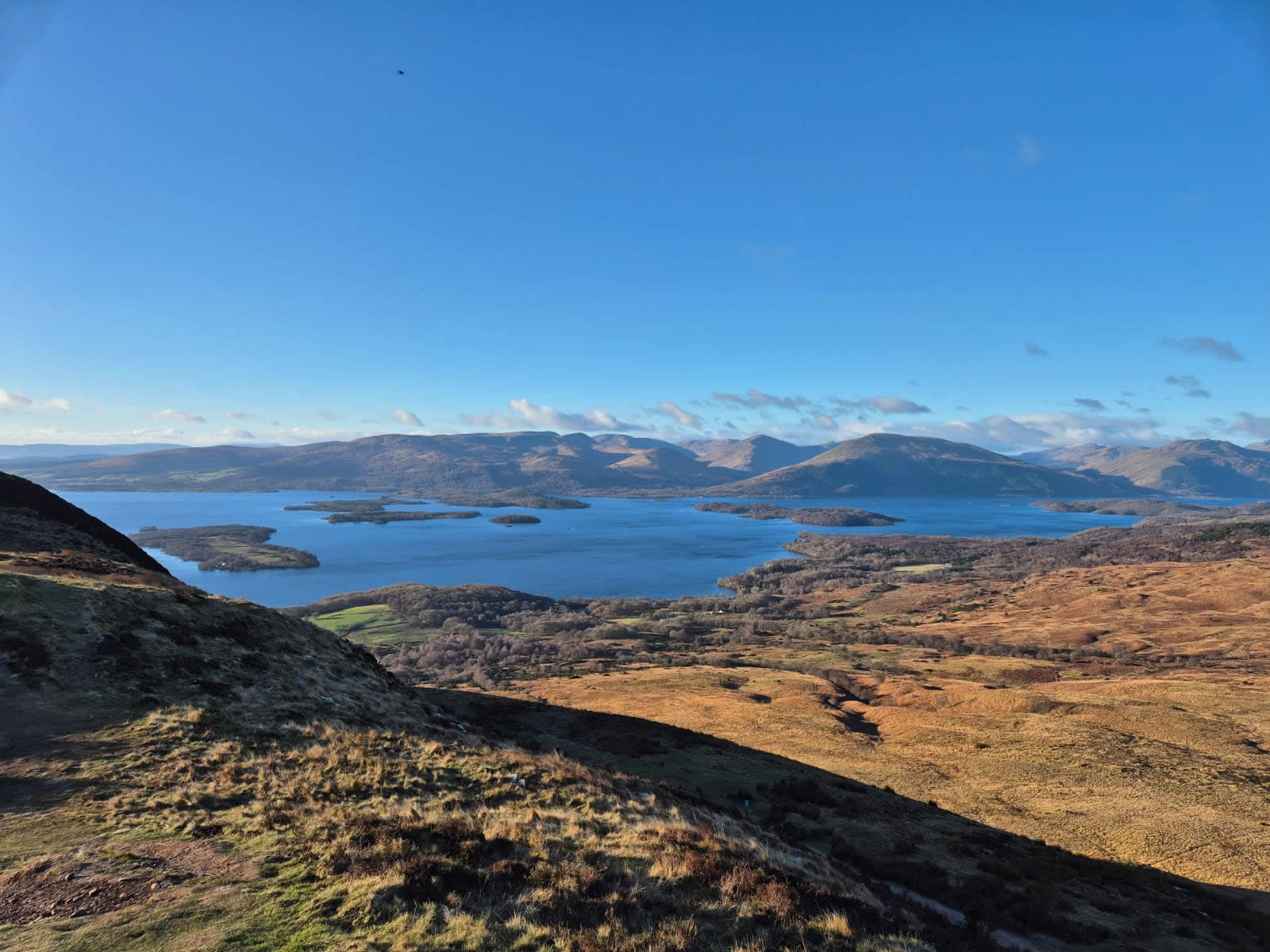
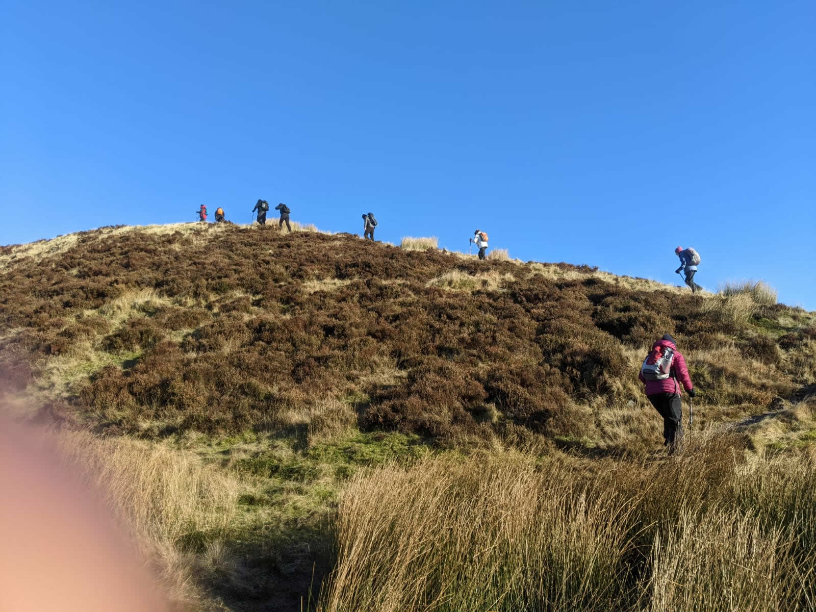
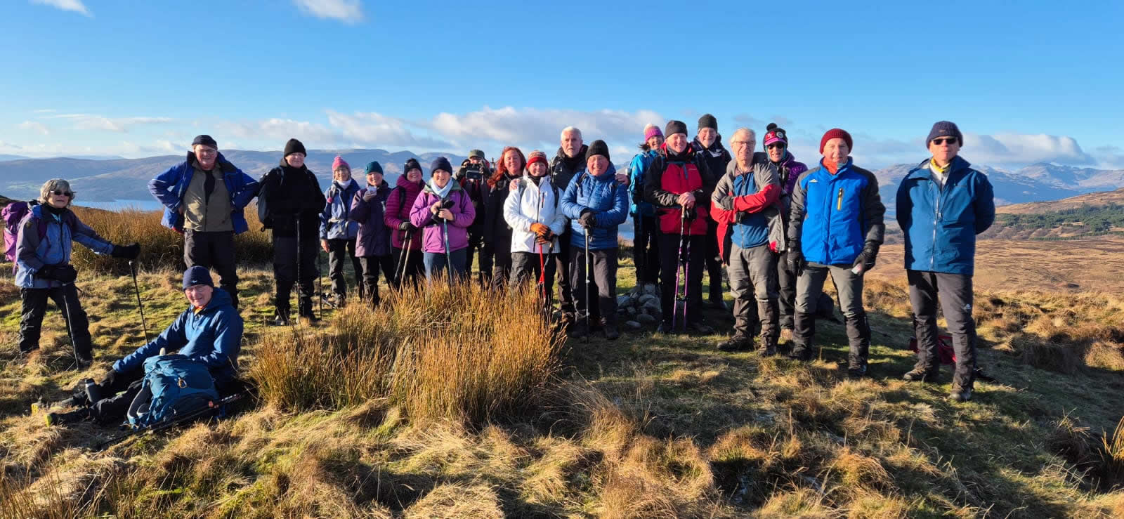
We did not linger on the very busy and overcrowded “summit” but headed east on a much more indistinct track dropping down and then up through the heather to the "true" summit, devoid of humans until our rather large group arrived and settled down for a spot of lunch in the glorious winter sunshine, and, much to our delight, a much lighter breeze than had been forecast, therefore keeping the wind-chill factor to a much more manageable level, cold, but not bitter cold, wonderful.
As the popular “summit” has it’s main path, so too does the true summit have it’s own path, not a fine stone man-made one, but rather an indistinct track through the heather which leads almost directly east off the summit and down the east shoulder of Conic Hill to rejoin the West Highland Way just as it descends to the bridge over the Burn of Mar and uphill to the point at which we had joined as we ascended from Gartincaber Farm. Our return, however, would keep us on the West Highland Way back over the open moorland until we re-entered the Garadbhan Forest, and this time, taking the upper, main track through the forest for a leisurely stroll back to the car park at the forest edge on the minor road above Drymen.
A brilliant day in all respect, weather, company and amazing scenery. Thanks Jack.
Photo Gallery
Click the buttons to select photo size.