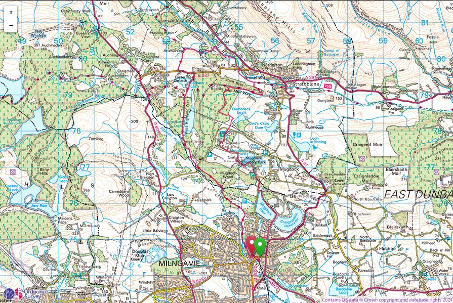
Mugdock Park Circular
Saturday 14th December 2024
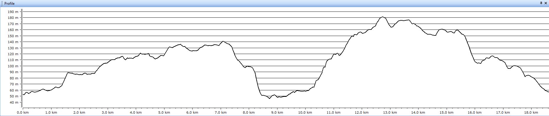
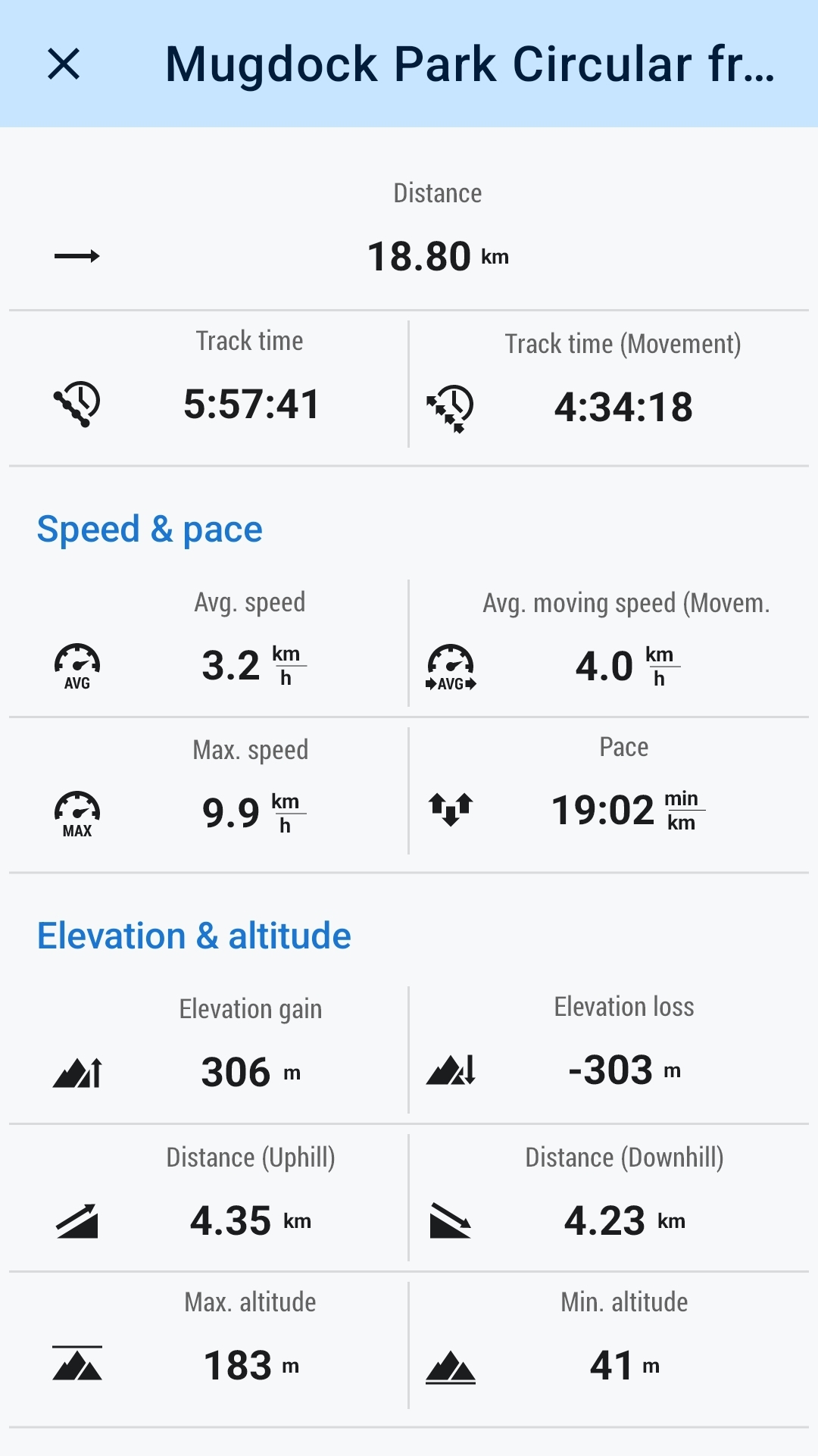
19kms
6hrs
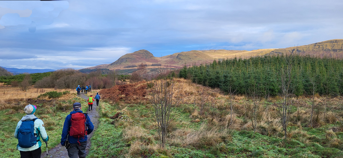
A mere few hundred metres from our start point in the car park at Milngavie railway station and the town is already behind us and the waters of the Allander Water flow by as we pass through the wooded Allander Park on the path well trodden by those embarking on the challenges of The West Highland Way. No long distance footpath for us today, but certainly a 19 kilometre walk offering a variety of options as to which turnings to take in the labyrinth of paths that we encountered throughout the day.
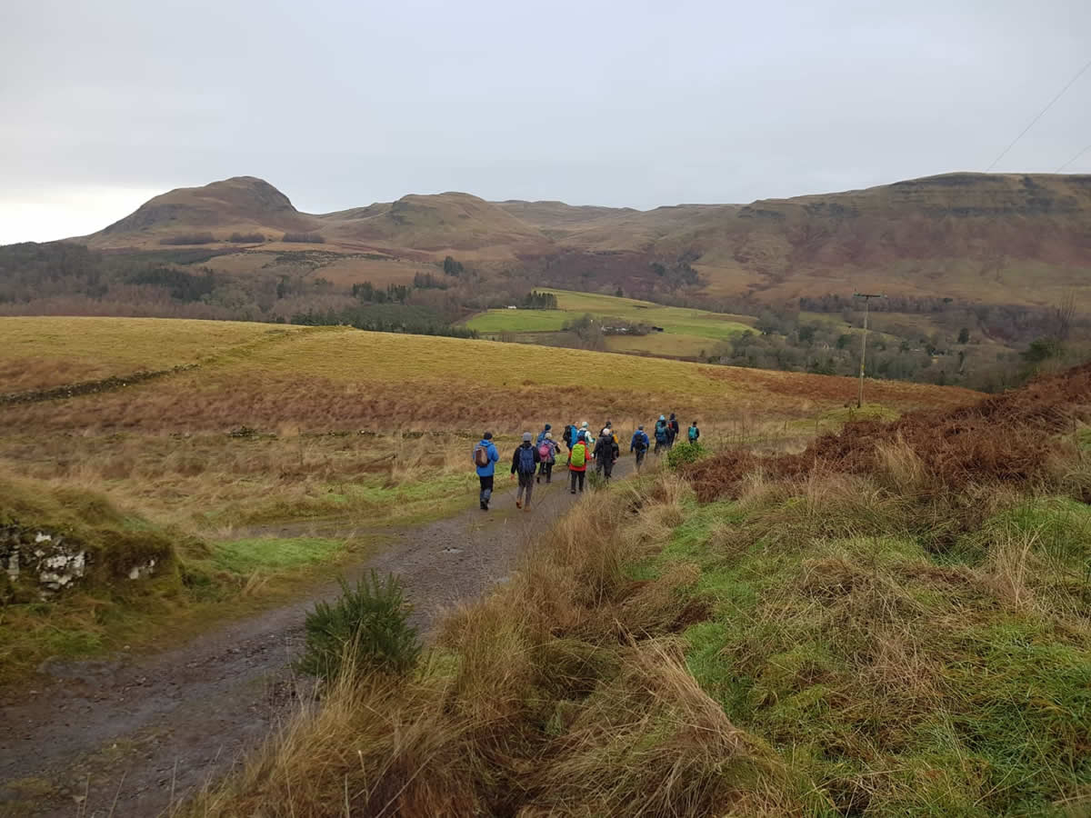
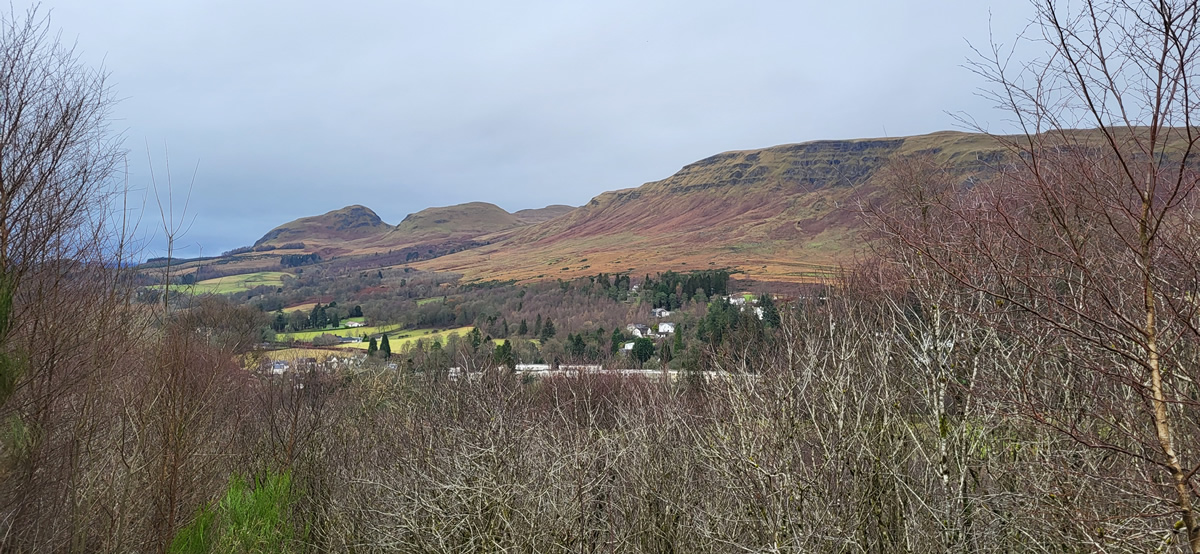
We covered the first eight kilometres of our walk on the West Highland way, taking in the wooded area of Scroggy Hill, the waters of Craigallian Loch and the Carbeth Huts where we took a short break just to take in the woodland views and enjoy a rain and mist free day, the first of the week.
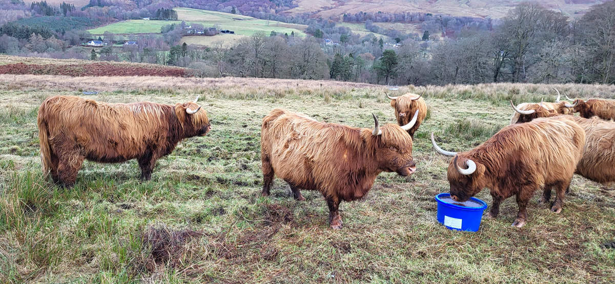
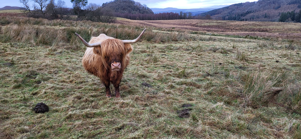
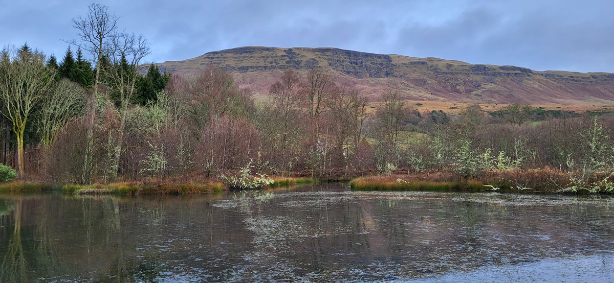
Beyond Carbeth, we continued a little further along The West Highland Way to the mound around Arlehaven, where once there stood a remote cottage, which alas has long since crumbled and it’s ruins lying somewhere below the grasses now coverings the open grazing land upon which it stood; albeit the grazing land is still in use as was evidenced by the small fold of Highland Cattle we came across as we swung east, leaving the WHW behind us and headed towards the old dismantled railway line before heading generally south east along the line of Strath Blane and a narrow woodland path along the banks of Blane Water to merge for a short distance with The John Muir Way and on into Mugdock Country Park.
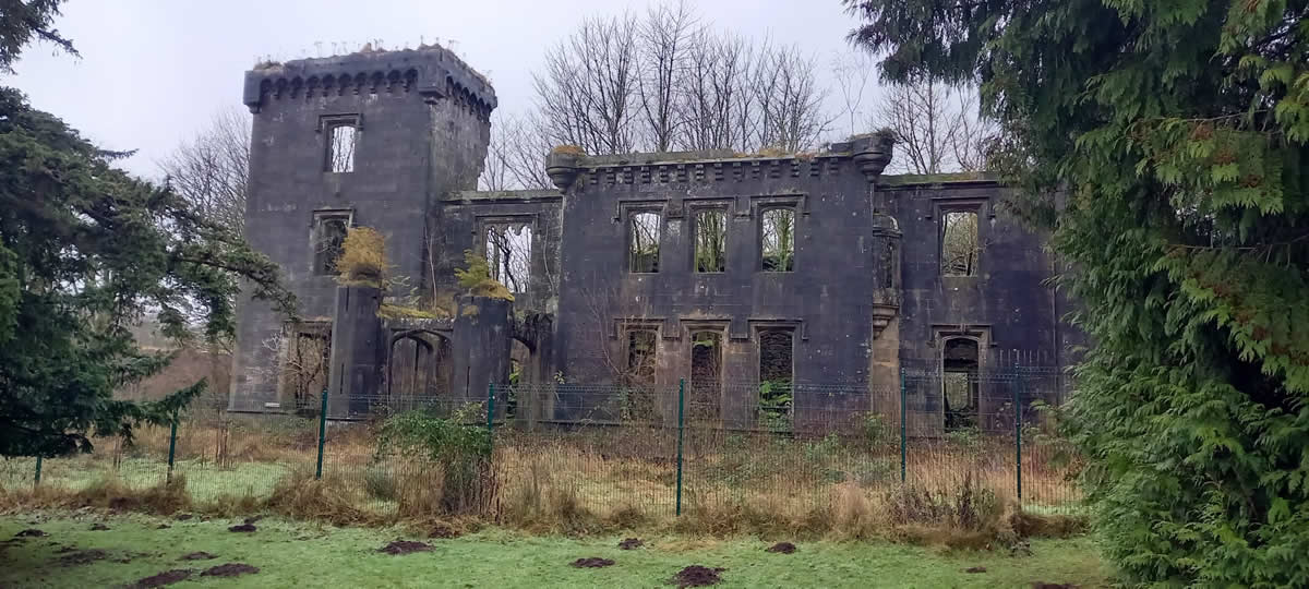
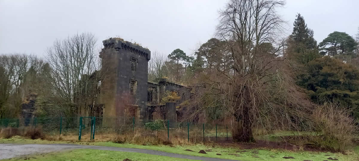
A winding route, through the main visitors centre, passed the ruins of Craigend Castle and a short wander around the remains of the Chapel and Mugdock Castle itself left us with a final section of woodland paths and walkways around Mugdock Reservoir and suddenly, once across the dividing embamkment between Mugdock Reservoir and Craigmaddie Reservoir we were suddenly back in the urban outskirts of Milngavie and a short walk back to our start point at the railway station.
A fine walk, and good leg stretcher, thanks Pat at everyone for your company
Thanks John
Photo Gallery
Click the buttons to select photo size.