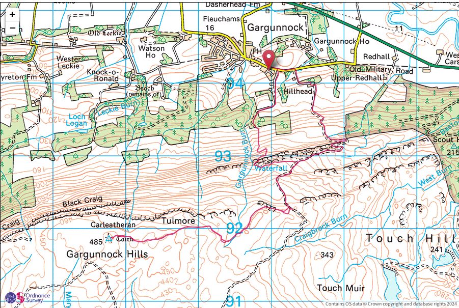
Carleatheran(485m)
Saturday 14th September 2024
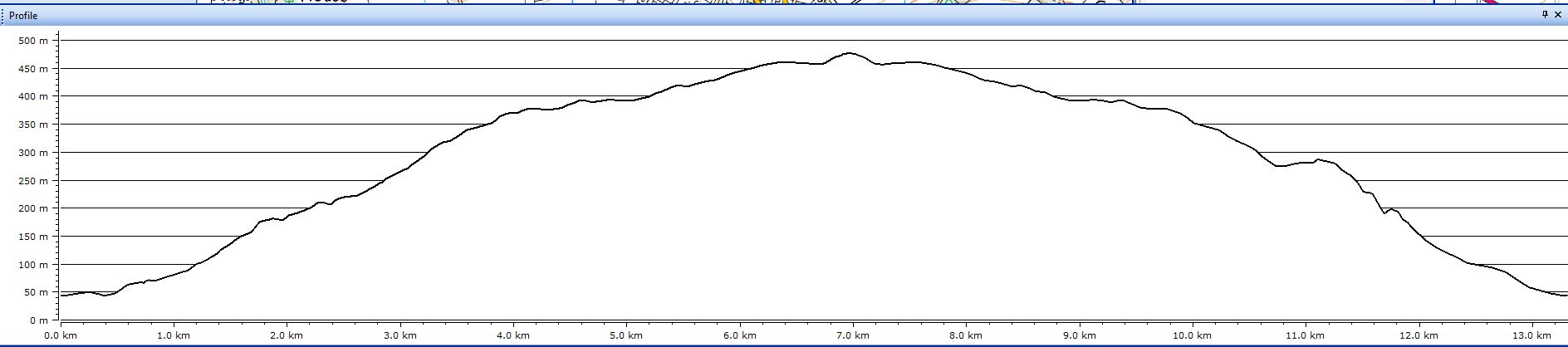
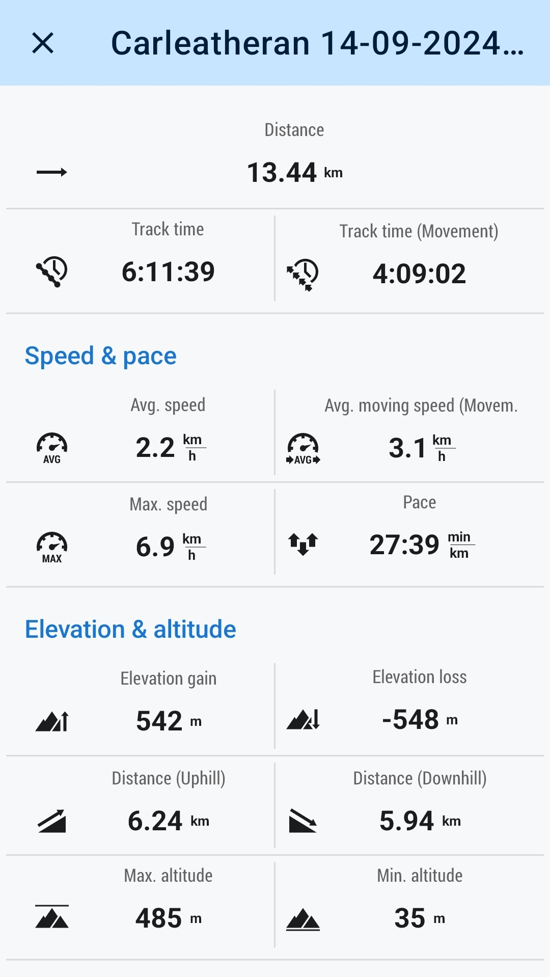
14kms
6hrs 15mins
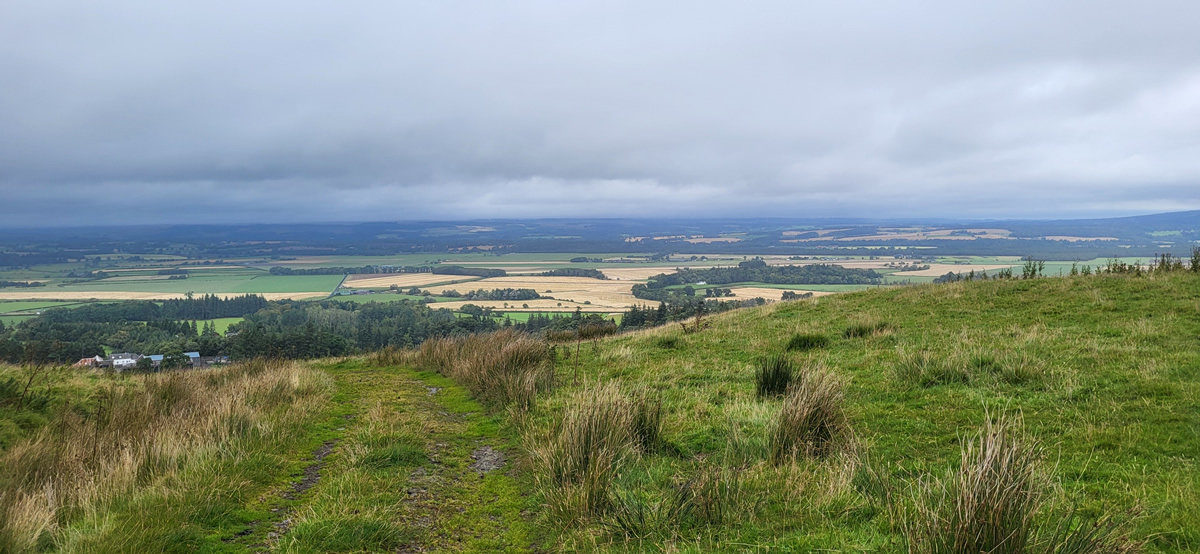
Looking south as you approach Stirling from the west along the A811 between Kippen and Stirling your eyes are drawn to a large escarpment a few kilometres across the open fields and which rises to a height of about 350 metres along it’s length, from the Fintry Hill in the west, to the Touch Hills in the east, a distance around the rim of approximately 15 kilometres, with the Gargunnock Hills sitting central to the whole area of rugged moorlands which lies beyond the escarpment. Such was the low cloud and mist as we drove towards the village of Gargunnock that we could not see the top of the escarpment, and there was a distinct feeling of rain in the air and a fairly stiff breeze blowing, and we had yet to start our walk. Interesting day ahead no doubt.
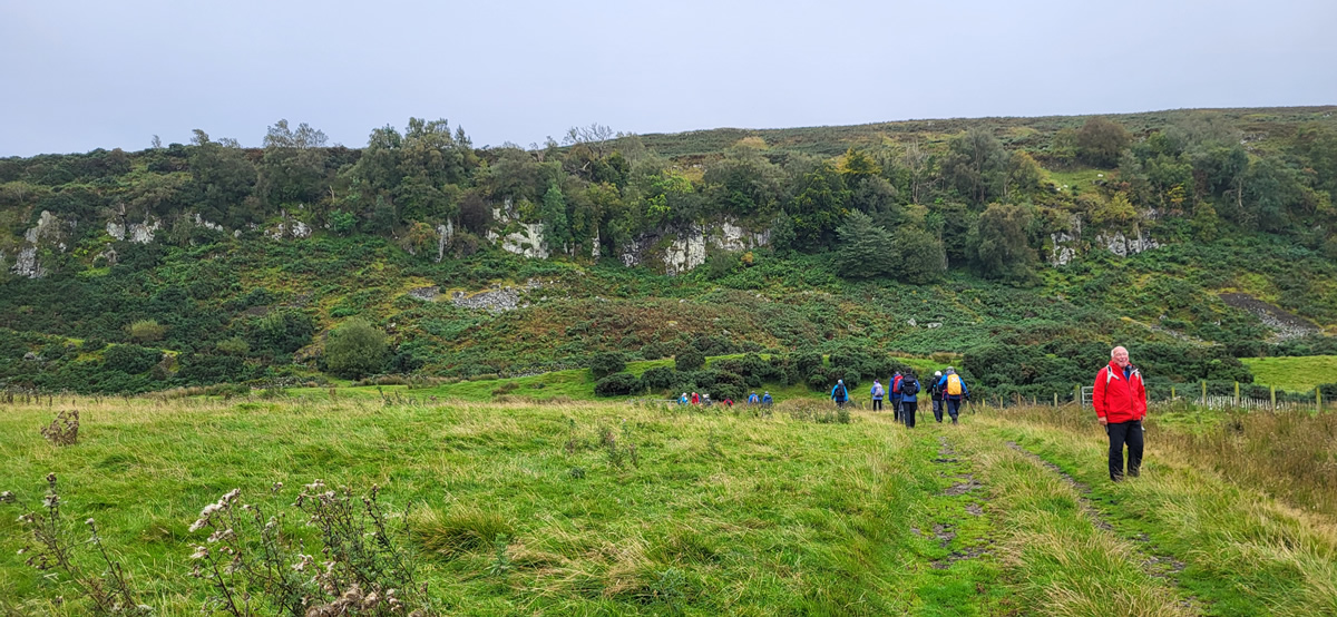
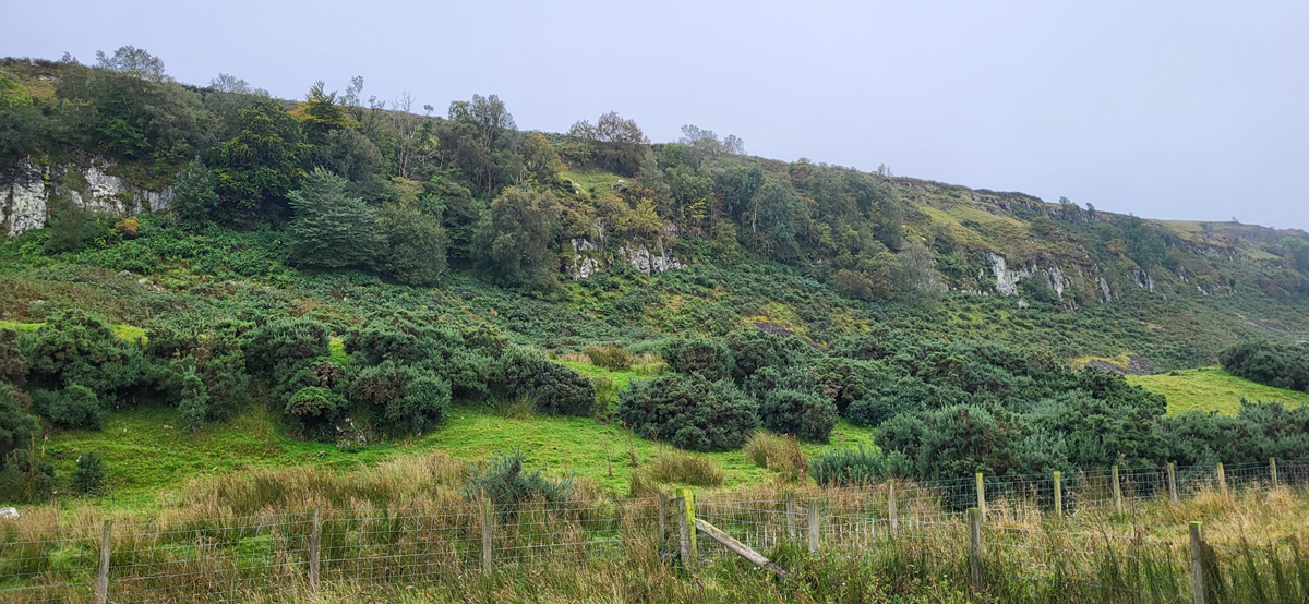
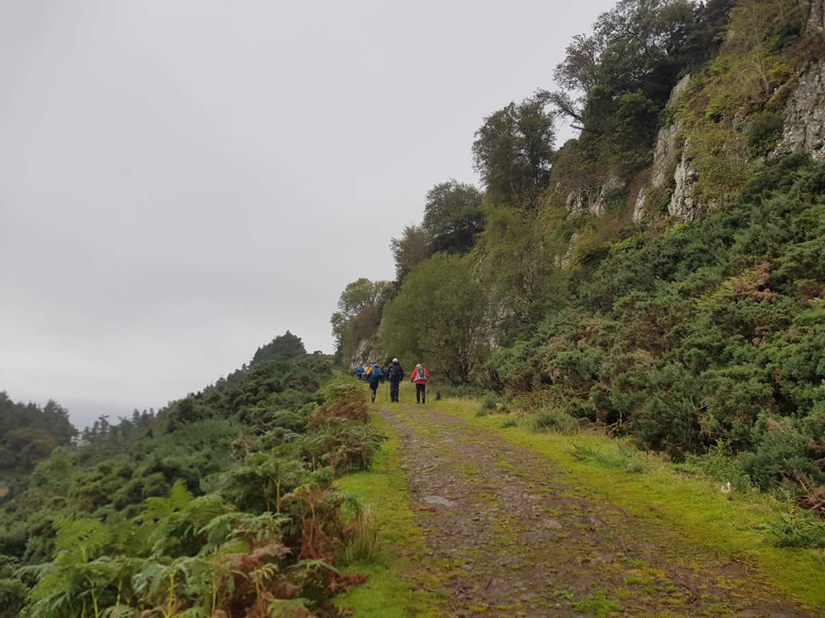
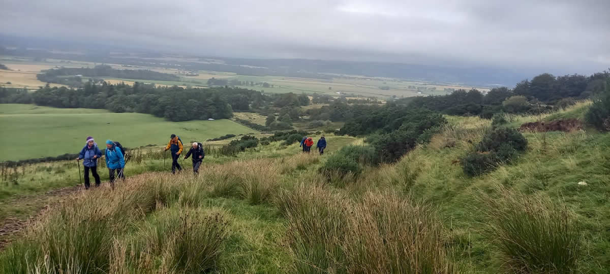
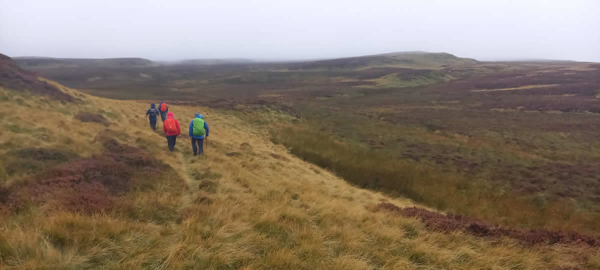
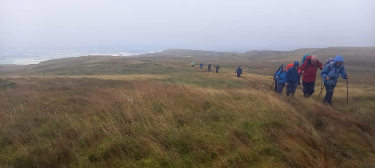
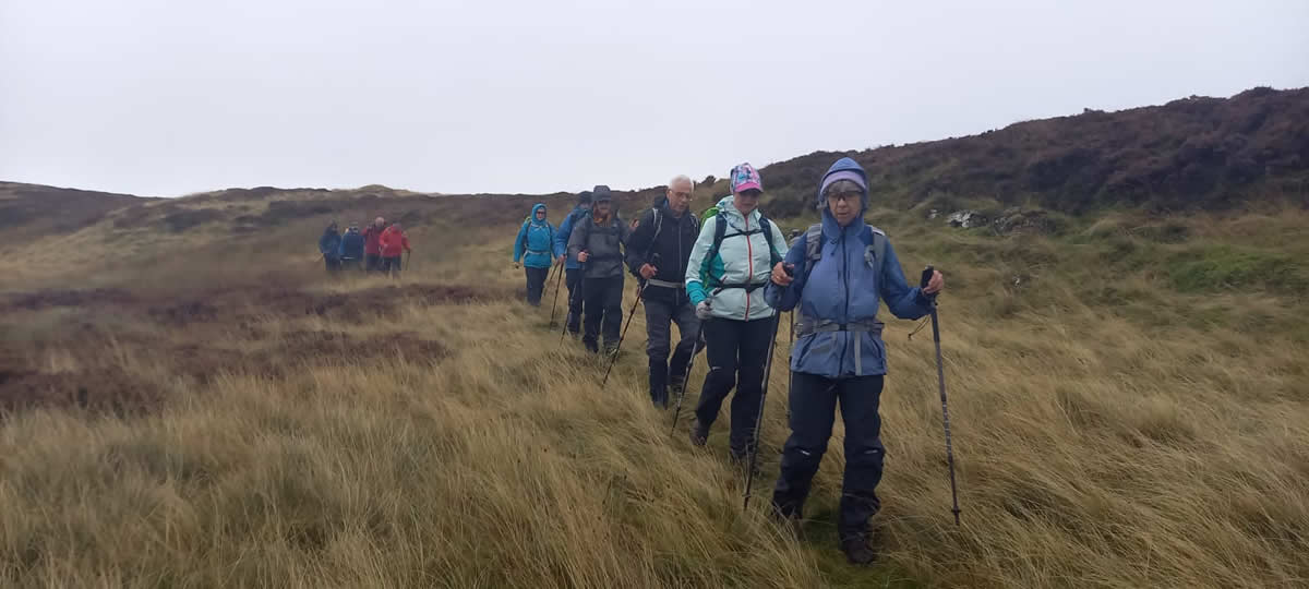
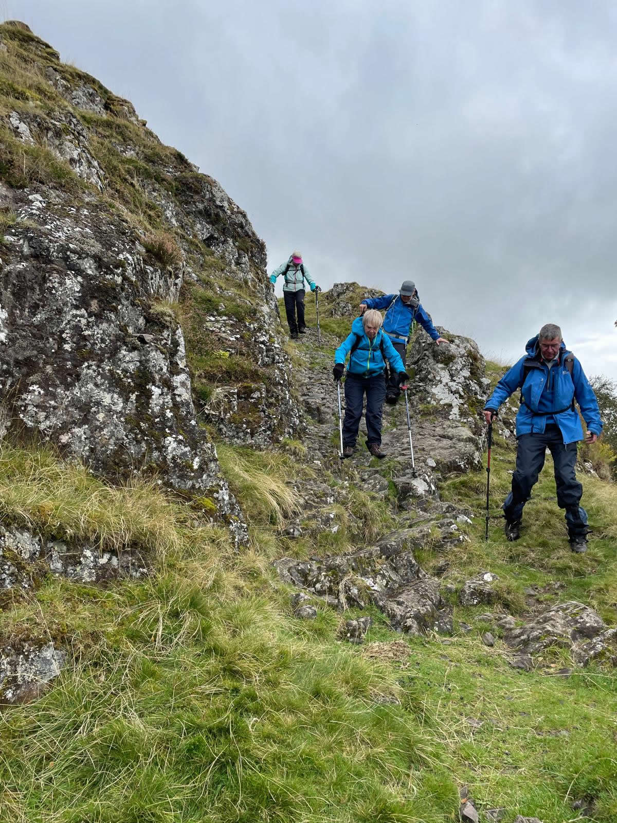
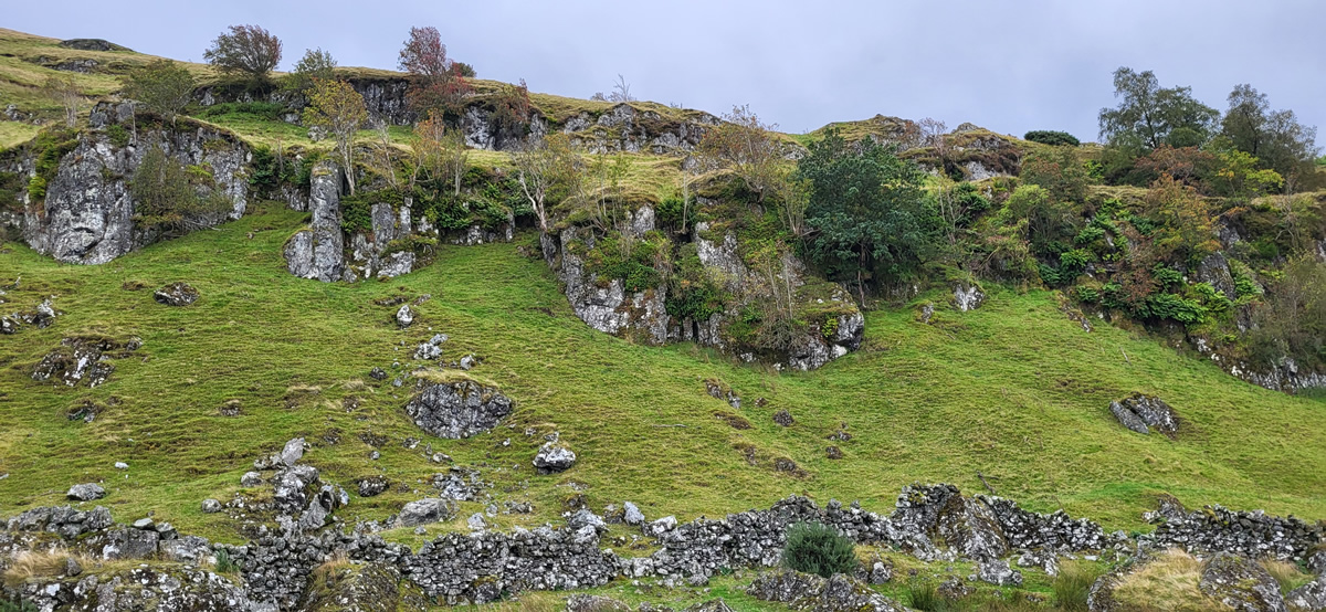
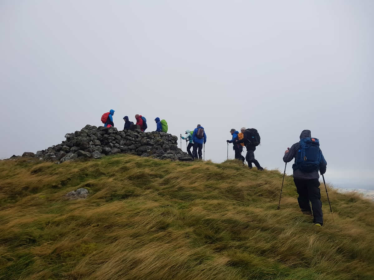
Departing east from Gargunnock village we picked up the farm track through Hillhead Farm and followed it all the way to the rocky crags which form an almost unbroken line along the whole length of the escarpment at which point we had a close-up view of the rocky nature of the line, and just how steeply the rocky face rises from it’s base, all of which looked fairly challenging on the approach. Thankfully, however, the track followed the line of a very broad grassy rake to make a winding, zigzag route up through the crags to the open moorlands above. Towards the top of the track we came across a substantial wooden lodge, most probably to facilitate the shooters using the grouse butts spread across the moorland ahead and around which we took shelter from the rather strong breeze that was blowing and hunkered down for a quick snack and drinks. Beyond the lodge a second, less obvious layer of crags mark the edge of the high point of the escarpment and lead onto the upper moorland. However, it was at this junction that we left the main track and headed west keeping a little below the high point of the moorlands to follow a very indistinct track which contoured around the edge of the moorland, at times through rough grasses and at others over wet mossy ground, but all the time heading generally west in the direction of the as yet invisible summit of Carleatheran. Invisible that is through the mist and drizzle that now shrouded the hillside, which, combined with the constant strong wind was making the going quite challenging. We had less than a kilometre of visibility on this rather featureless hillside, but Pat had all in hand from a thorough recce and was on track for the invisible summit. And, just to keep my skills up I found myself checking our position as 800 metre distance on a bearing of 263 degrees to the summit, and started my pacing, 66 steps to 100 metres for me, and I was down to 400 metres before the walled cairn and top of the Trig Point came into view through the gloom. So how did my pacing go, not bad, I ran out my 800 metres less than 100 metres from the summit, which considering it was a straight line bearing and distance I had taken but a twisting route to the summit was a fair result.
The summit was a bleak and windy place, but needs must, and we once again hunkered down in or around the stone walled cairn to take on some very welcome refreshments and just to get a break from bashing into the wind.
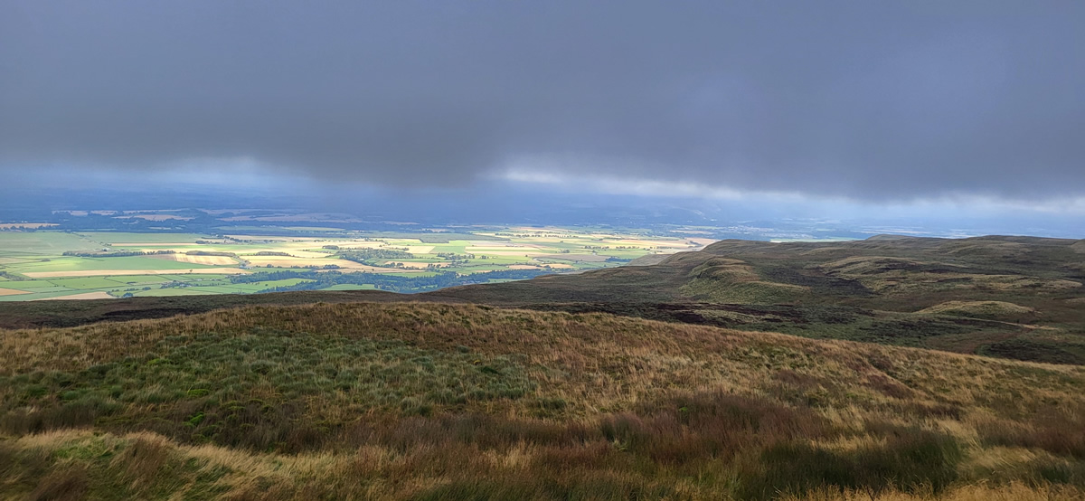
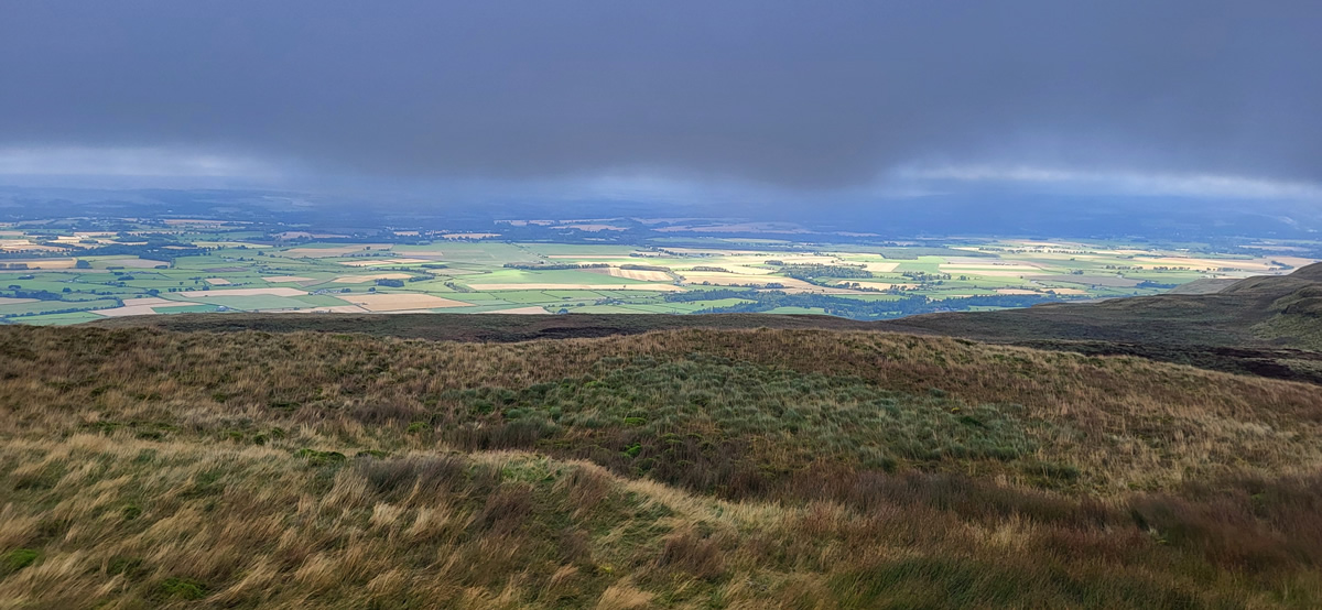
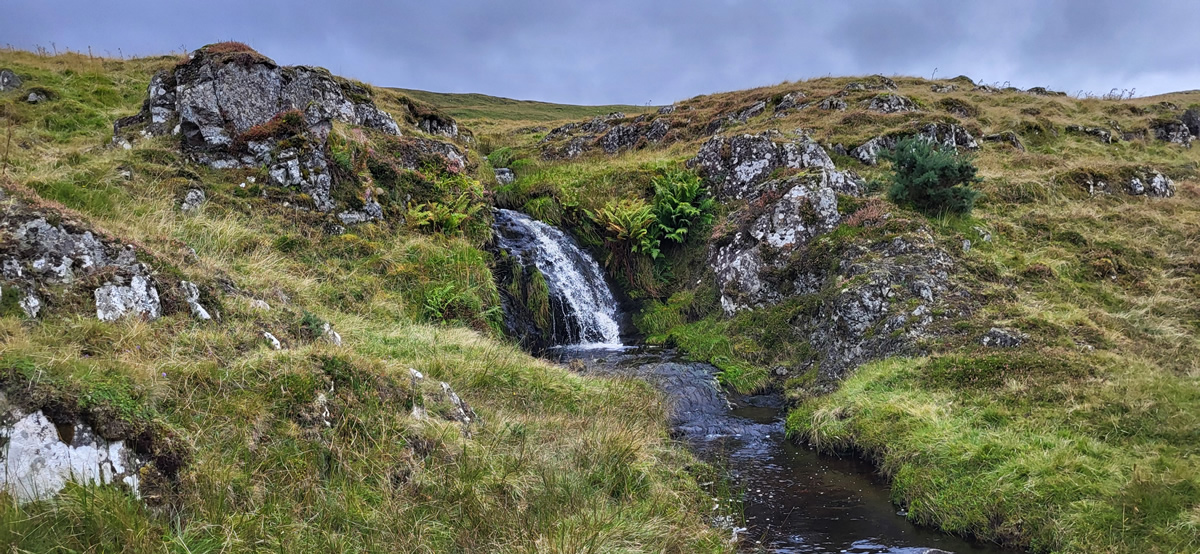
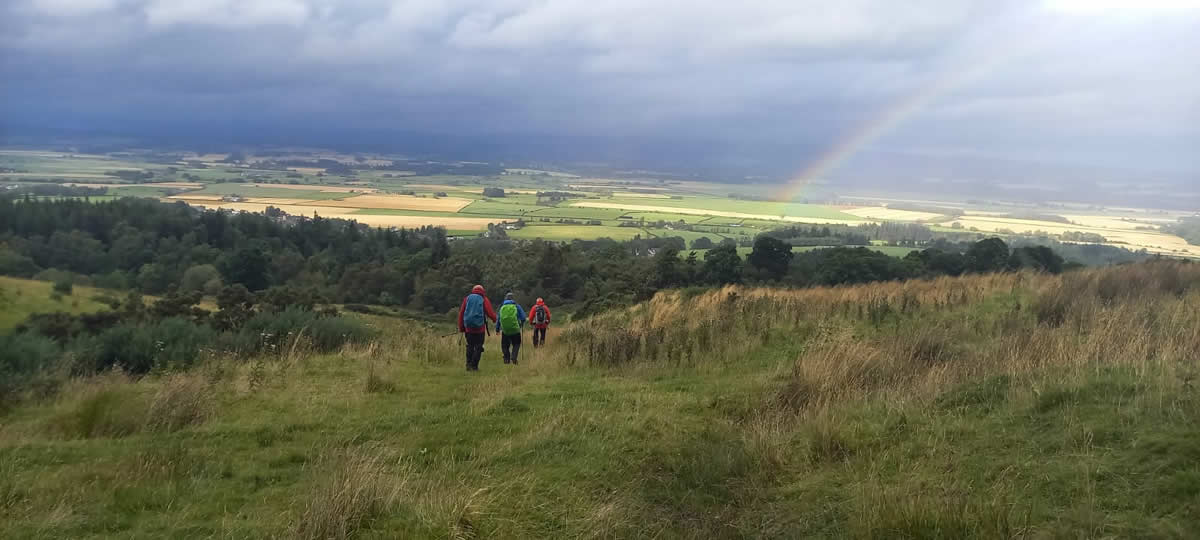
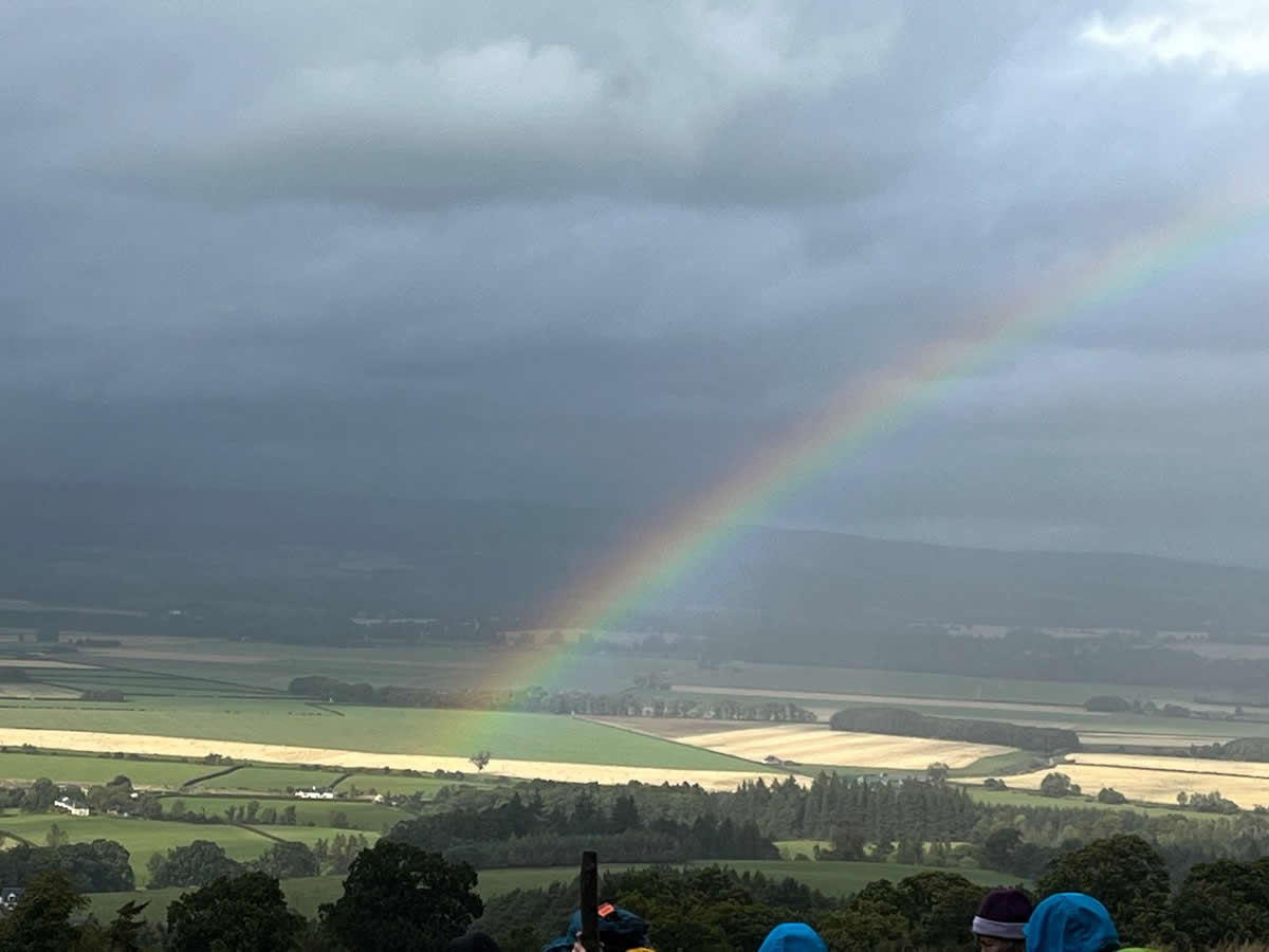
Thankfully the wind was more side-on as we returned across the open moorland retracing our outward route until we were back on the track just beyond the wooden lodge, at which point a detour was taken to allow us to visit the waterfall at Downie’s Loup. An interesting spot and a fine viewpoint looking over the Carse of Stirling, where a fine rainbow against a dark sky beckoned us back into Gargunnock at the end of a very interesting day on the wild moorlands that we so often ignore in preference to the more mountainous hills.
A great day, Thanks Pat, and all for your company.
Photo Gallery
Click the buttons to select photo size.