Beinn Odhar(901m)
Saturday 31st August 2024
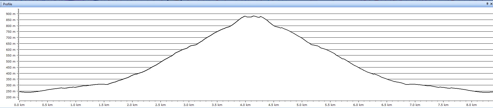
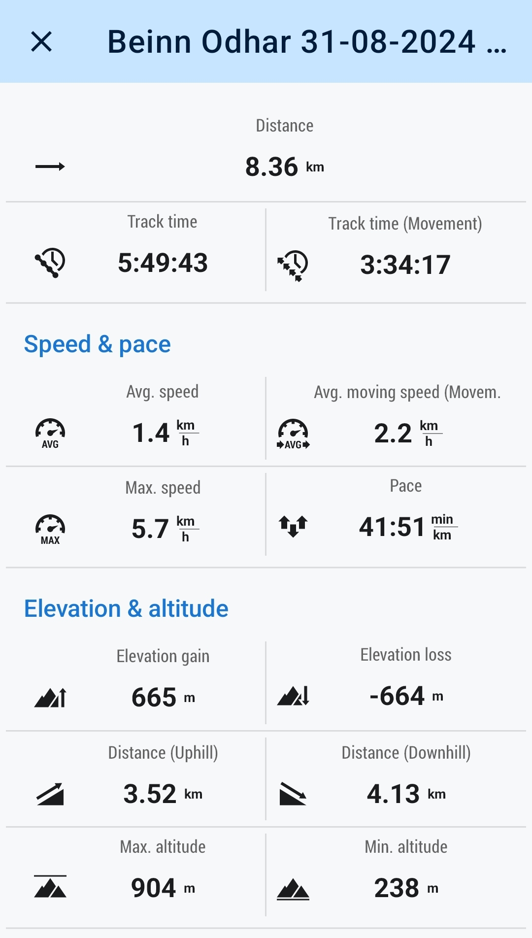
9kms
9hrs 45mins
Any thoughts of taking to the hills last weekend were quickly dashed with a weather forecast of very heavy rain and strong winds. So it was great to see that the forecast for this weekend, especially Saturday, was for high pressure bringing long sunny periods with lighter winds, ideal hill conditions.
Beinn Odhar had been bandied about of late; it’s a great hill which I had climbed on three previous occasions, twice as winter walks directly up the broad south ridge from Tyndrum, and once in summer but from Dalrigh via Meall Buidhe. I mention this because today was to be an interesting insight into the development of mapping apps and new mapping options. To those of my age group it is probably fair to say that Ordnance Survey maps were the only maps we would ever think of using on the hills, I know I did. That was until some years ago when I started using Harvey Maps whenever possible, although in the early days of Harvey maps they were very limited in the areas that they covered, therefore I tended to swop between OS and Harveys whichever I felt suited my needs best for a particular walk. Fast forward from my first use of Harvey to the Mobile age and we now have a multitude of apps available on our phones covering almost every area of the UK (and abroad if needed). But be aware, not all maps are equal!
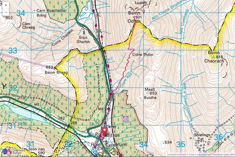
The two winter walks previously mentioned were completed over the 2014-2015 winter when there was a heavy covering of snow throughout the area. Pre planning with the OS maps presented us with a blank hillside from the WHW to the summit of Beinn Odhar, no paths or trails on either the 25,000 or 50,000 OS maps. And so on both occasions we just left the WHW and headed directly up the spine of the broad ridge making a bee-line for the mine, lochan and finally summit, and then simply reversing our route to follow our footsteps in the snow for the return, what was underfoot was a mystery, the snow covered everything. Fast forward to last week, and I am looking at Harvey Maps and they clearly show a path from the WHW to the mine but not up the spine of the ridge, rather it initially followed the line of the Crom Alt towards Coire Thoin before climbing in a series of zigzags and then a final burst west to the mine.
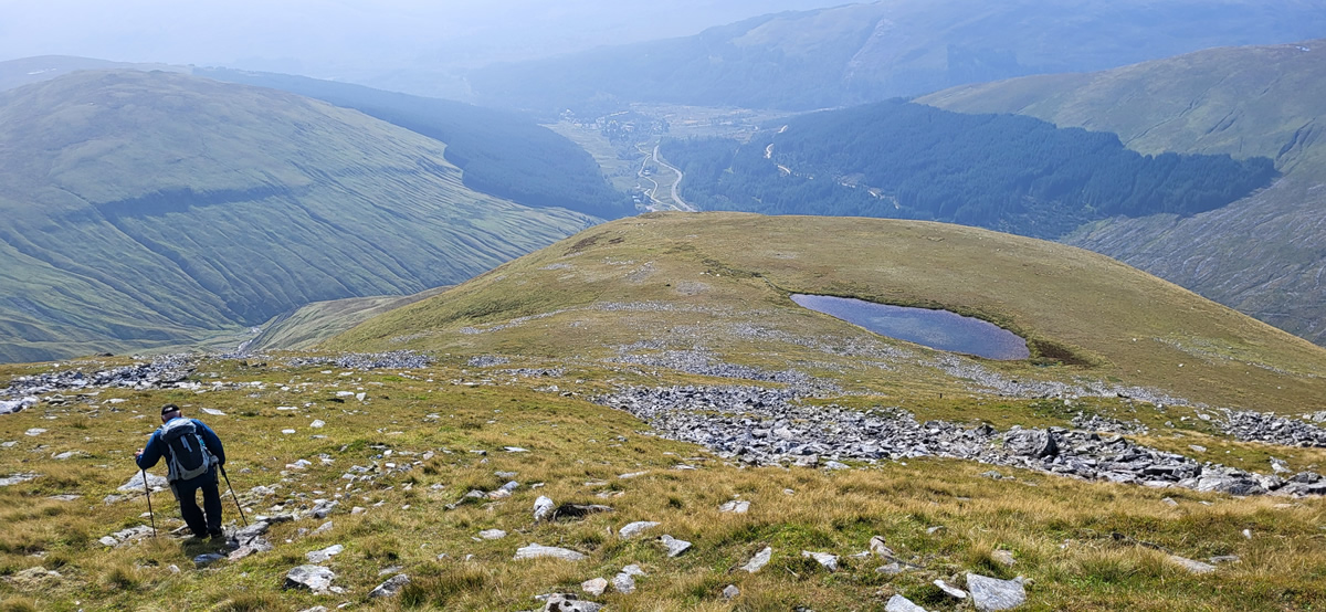
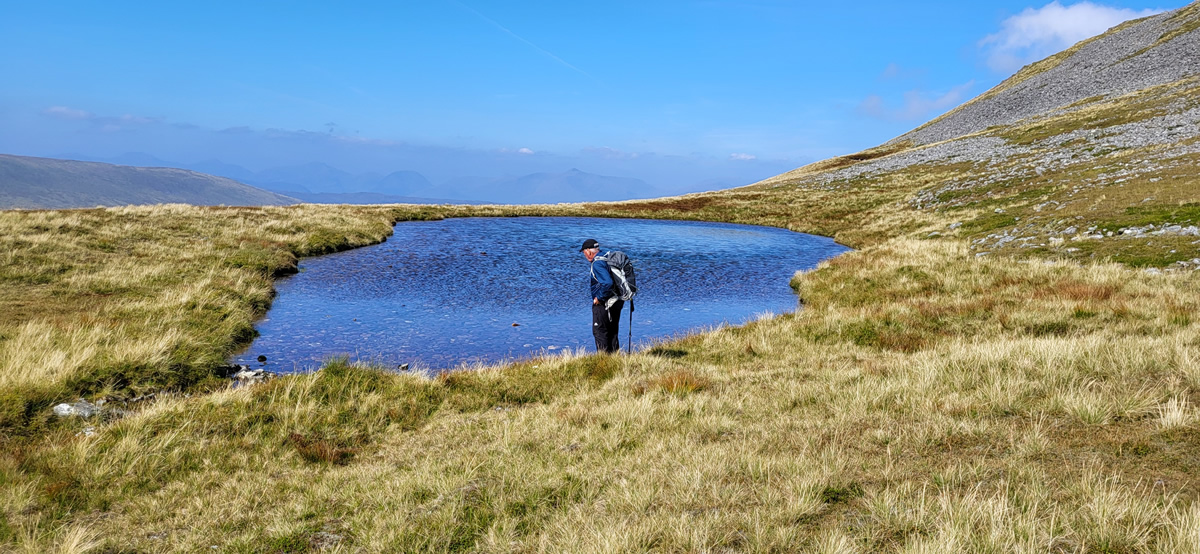
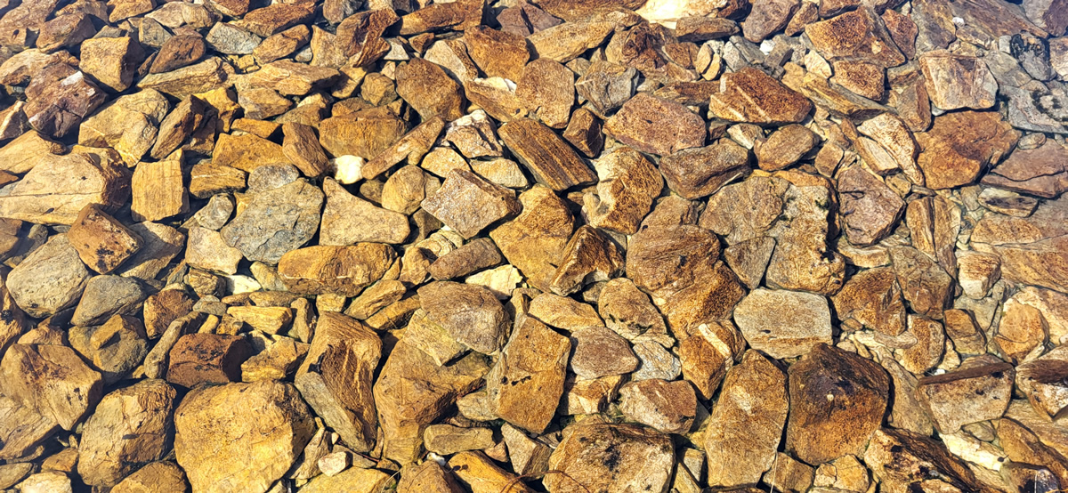
As we left Tyndrum Ian was also of the opinion that he an idea that a path of sorts did exist, the problem was, where! So, passing through the gate to leave the WHW and onto the hillside we deliberately angled right (east) towards the Crom Alt and trod through an area of thick grass looking for the path as shown on the Harvey map, and sure enough a couple of hundred metres on there was a broken stone path, not wide bud distinct enough to follow, and follow it we did. The stone soon gave way to grass, the path narrowing even more to a single step width, but all the time heading as shown on the Harvey map. Soon we encountered the zigzags, distinct enough so long as you kept your eyes on the look out for the zigs and zags as it gained height. A longish climbing contour at the end of the zigzags and a final turn west over some rocky section and we were at the mine entrance, just prior to which a couple who I had noticed for some time coming up behind us on the same track caught up with us, a quick chat and they were off, but it was interesting to see others on the same track. Haveys have the track ending at the mine entrance, but it was clear it continued uphill, and so we followed it to where it did end, at the lochan, at which point we felt quite pleased with our “find”, a relaxed and steady climb what more could we ask for.
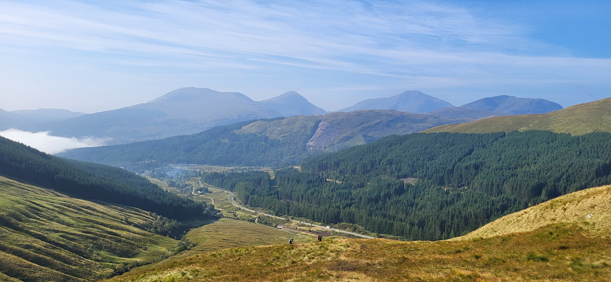
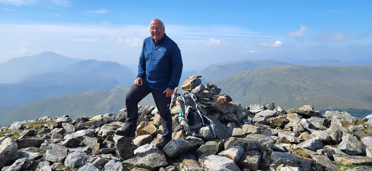
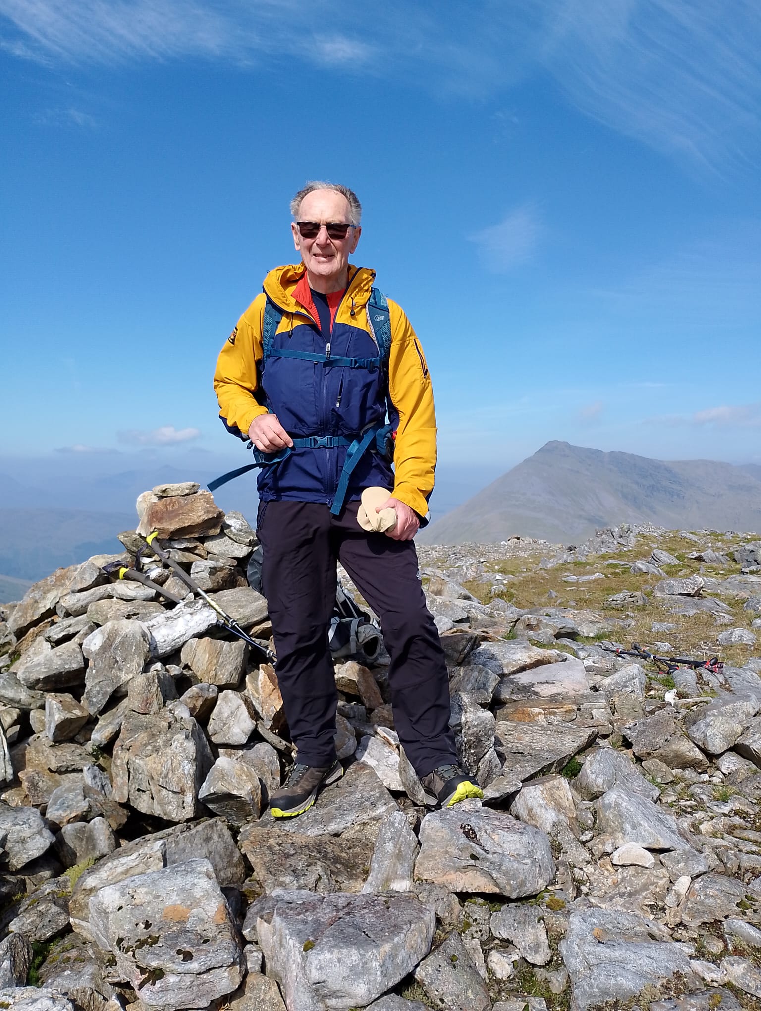
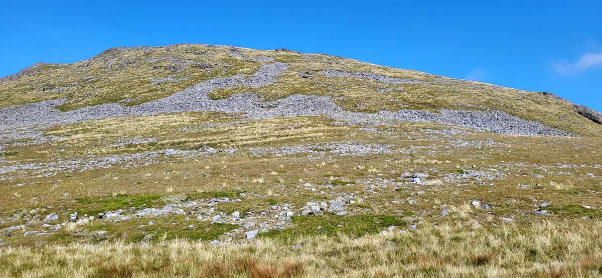
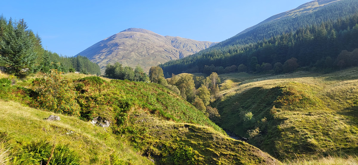
From the lochan we surveyed the patchy rock and grass approach to the summit and picked out the shortest rock crossing to keep us on the grassier areas for the final approach to the summit. A brilliant climb, the photos tell the story of t.he beautiful weather, such that we settled down for a full 45 minutes of quiet and solitude on a fine mountain top.
We retraced our steps for the descent, during which we met the only other couple for the day, a young couple who wanted just some re-assurance as to track and time to the summit, as they were using “an app” which showed them on track. And that brings me back to maps and apps.
A quick check and I find that OS 25000 and 50000 maps show no tracks on the south ridge of Beinn Odhar, as I already knew, but oddly enough, if using the OS App and you switch to their Standard map, very little other than contours shown, then the track is shown. As it also is on Locus Maps, and Outdoor Active, both contours and no other definition. Walkhighlands also show the track, but again not on their OS maps, just the contour mappling.
Having said all of that, I would caution on relying purely on apps and maps with little detail, I will still do my planning using either or both OS and Harvey Maps, but then it may be interesting to swop to the less detailed options on the apps just to check if they show any additional tracks or trails. Anyway, enough ranting on about maps, I just find them so interesting.
It was a great day in marvellous weather irrespective of which route we ended up using. Thanks Ian, another wonderful day in the hills. John
Photo Gallery
Click the buttons to select photo size.