Dunmore Ford and Bochastle Hill
Saturday 22nd March 2025
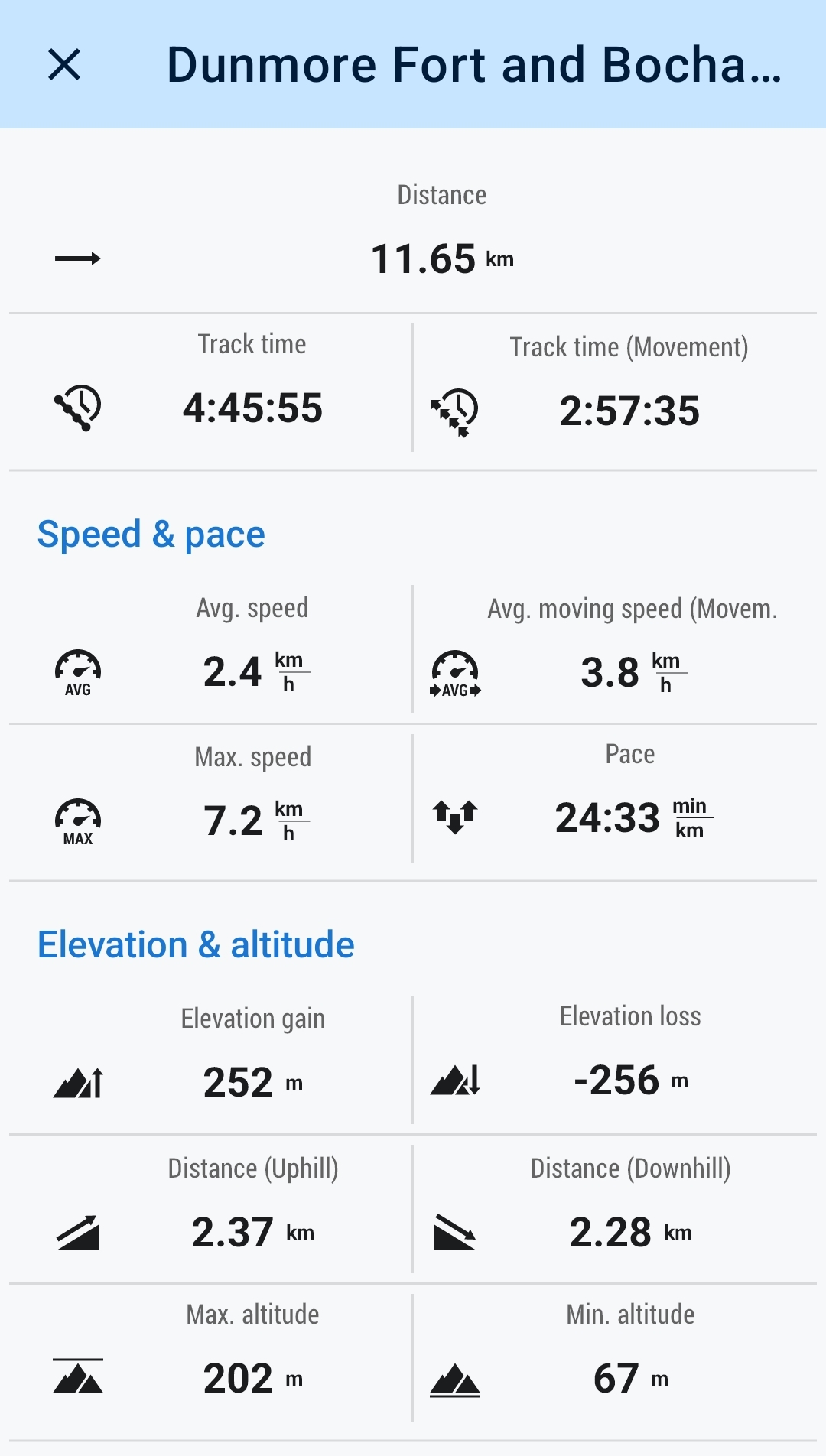
12kms
5hrs

If you look hard enough, every walk has a tail to tell; and we did not have far to look for todays walk, with tales from prehistoric times to mythical relics, Roman invaders, forfeited estates and a highland folk hero or outlaw, whichever your belief. A low level walk with plenty of talking points enroute.
Shortly after leaving the parking area just beyond The Lade and walking along the disused railway track towards Callander the remains of a Roman fort are clearly visible in the fields alongside the tarmac track. First established as a “marching camp” during Agricola’s campaign in 81 AD and upgraded to a fort in 85 AD during in the governorship of Sallustius Lucullus the fort was one of a number built to help control the Highlanders in the north. (Click Here for further information on Roman Fort)
We continued along the banks of the Garbh Uisge to pass through Callander where the confluence of the Garbh Uisge and Eas Gobhain form the River Teith to a quiet, picturesque spot where we had a short break before turning west again to gain the tracks through Coilhallan Wood towards the shores of Loch Venachar and the picnic spot by the old Quay, where a calm and misty loch side provided yet another ideal spot for some lunch. Our route so far has been along section of The Great Trossachs Path and The Rob Roy Way, established in 2002 and named after the 18th century folk hero Rob Roy MacGregor, hero or outlaw, or maybe a bit of both, either way, his name is synonymous with numerous locations around the Trossachs and further afield in the highlands and lowlands of Scotland.
Retracing our steps for a short distance we crossed the Eas Gobhain by Gartchonzie Bridge, another part of 18th century Scottish history, when the Duke of Perth’s estates were forfeited when he chose the wrong side in the 1745 Jabobite Uprisings. Built in 1777 the bridge was to improve the general access to the estate. (Click Here for further information on Gartochonzie Bridge)
Recrossing The Great Trossachs Path we made a short sharp climb up the grassy slopes to the hill top Dunmore Fort, a prehistoric fort with well defined circular earthwork defences, best seen from a nearby hill, but still visible as you descend the north side enroute to Bochastle Hill and the mythical Samson’s Stone, an erratic schist boulder , but unlike many other large boulders this one does not show any evidence of a cupmark or any other prehistoric art details. (Click Here for further information on Dunmore Fort) or (Click Here for further informationon Samson's Stone
A very short descent from Bochastle Hill and onto the Great Trossachs Path and we were soon back at the car park at the end of what was a very enjoyable and interesting walk. I have included links to some websites if anyone is interested in further reading on any of the historic aspects of the walk. Great day, thanks Idris.
John
Photo Gallery
Click the buttons to select photo size.


