Greenock Cut and Dunrod Hill(298m)
Saturday 13th April 2024
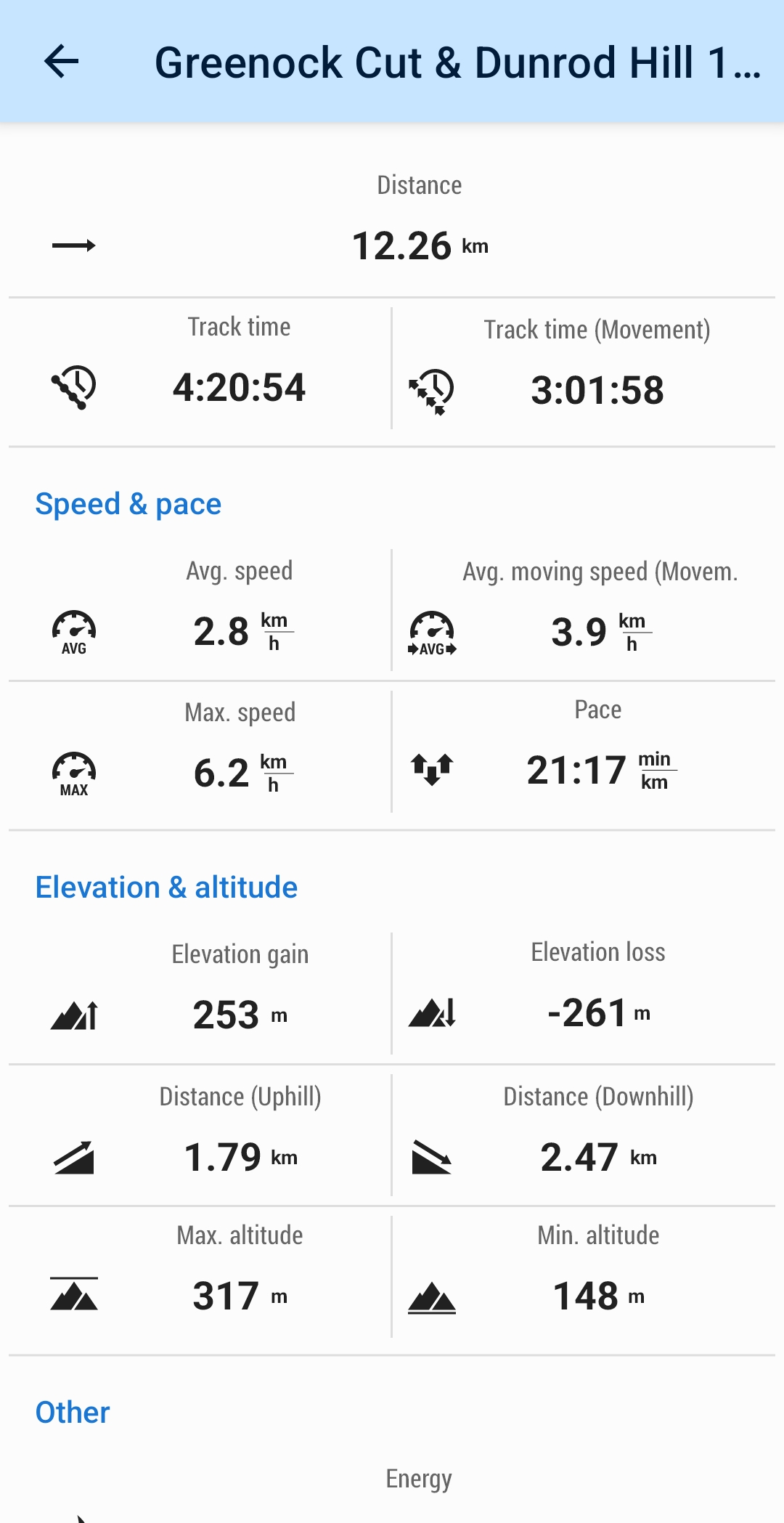
12kms
4hrs 15mins

The forecast for today was for a damp dreich day, but as we started off from the parking area at Overton it was at least still dry, although rather cloudy. Taking an anti-clockwise circuit of the Cut, we were quickly rewarded with views over the built up areas of Greenock and Gourock and across the River Clyde towards the Rosneath Peninsula and the Argyll Hills. The well maintained path that contours the hillside runs adjacent to the early 19th century aqueduct which was built to supply water to Greenock at a time of rapid social and industrial expansion in the area. And, as is the case with any aqueduct, it’s course is generally over a very level plain with minimal gradient, meaning that the adjoining path has similar characteristics, making for extremely easy and leisurely walking, but, due to it’s raised elevation on the hillside still providing some magnificent views over the Firth of Clyde.
The ”Cut” itself offers some interesting points, not least of which are the numerous small stone arch bridge structures which give access to and from the hillside beyond the aqueduct, and two structures which may have been used as accommodation or shelters for those who worked on and maintained the aqueduct.
After 7 kilometres of easy walking the “Cut” is left behind at Shielhill farm, at which point there are two options; continue on the good track and return to Overton via Compensation Reservoir and Loch Thom, or divert onto the pathless hillside and visit the high point of Dunrod Hill which lies just above Shielhill farm. Today, Bernadette opted for the second option, Dunrod Hill.
We had left Overton in dry conditions, but, that did not last for long, and by the time we were skirting Shielhill farm and taking to the open hillside it was raining fairly steadily and the ground underfoot wet and soggy. It was a fairly short climb, and just steep enough to let us know we had left the easy walking behind, and as we reached the trig point on the 298 metre summit, the rain and mist were closing in on us. Nevertheless, we found a spot to hunker down and take a lunch break, during which the weather worsened in that the rain turned to hailstones and the visibility dropped considerably. It was still hail and poor visibility as we packed up and headed for the nearby Hillside Hill, just a short distance to the east, over some boggy ground and with a short steep climb to the cairn marking the 297 metre summit, by which time the hail had ceased and the mist dispersed, bringing with it some nice, clear visibility once again.
Just over a kilometre away, across open moorland we could clearly see the aerial masts on Scroggy Bank, our next destination, reached after a plod over a tussocky, pathless moor and a contour around a small hilltop and finally the broad track leading to the aerials on Scroggy Bank, by which time the weather was improving as it was now dry and bright for the final leg of our walk via a fine track to Overton.
An interesting walk with some fine views and a pleasant moorland section. Thanks Bernadette, and all for your fine company. John
Photo Gallery
Click the buttons to select photo size.


