Beinn Chabhair(933m)
Saturday 12th June 2021
13kms
8hrs
Writing of previous ascents of Beinn Chabhair, I have commented on what a fine ridgeline it presents; a rocky path which twists and turns, dips and climbs to a fine summit. The problem is not the ridgeline, but the first 300 metres of ascent which starts immediately you leave the car park in Beinglas Campsite. A tortuous rocky path zigzags up the steep hillside with bracken, shrubbery and small trees encroaching on the narrow path and threatening to catch the legs, body or head of the unsuspecting, what, with one eye on where you are putting the next footstep, and one eye on the lookout for any overhanging greenery it is a demanding climb up, alongside of the waterfall and onto the open moorlands at the 300 metre height.
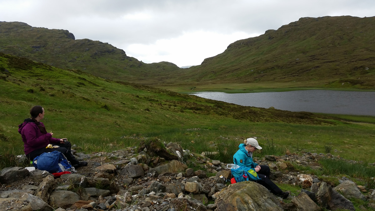
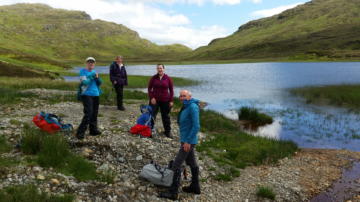
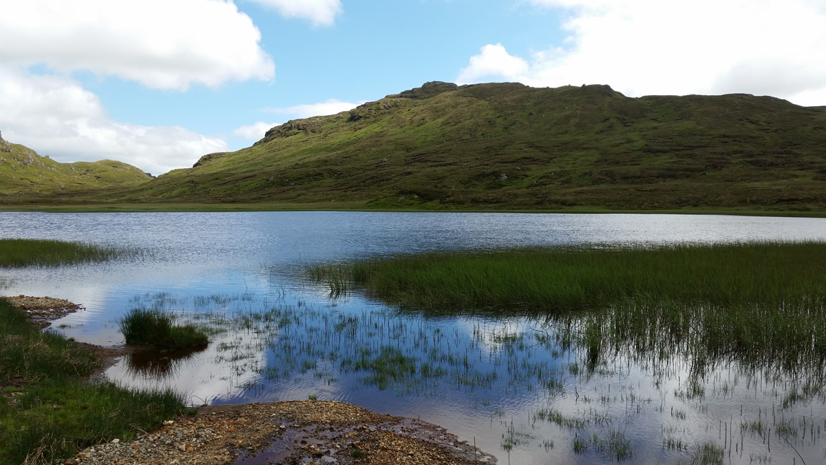
Finally, there is some respite to be had over the gently rising heather clad moorland as you then follow the course of the Ben Glas Burn for the next 3 kilometres to the fine Lochan Beinn Chabhair situated at the base of the main ridgeline of Beinn Chabhair. A ridgline which was well hidden behind a fairly thick cloudbase, contrary to the forecast, which promised good to excellent visibility and no rain. Not, so, as half way along the trek to the lochan we had to stop and don full waterproofs, top and bottom, as a persistent heavy drizzle was just too much for the light gear to handle. However, this did not detract from making the most of our arrival at the lochan, as this is always a pleasant spot to stop, enjoy the quiet and to refuel the legs for the next stage, the climb to, and then along the main ridgeline.
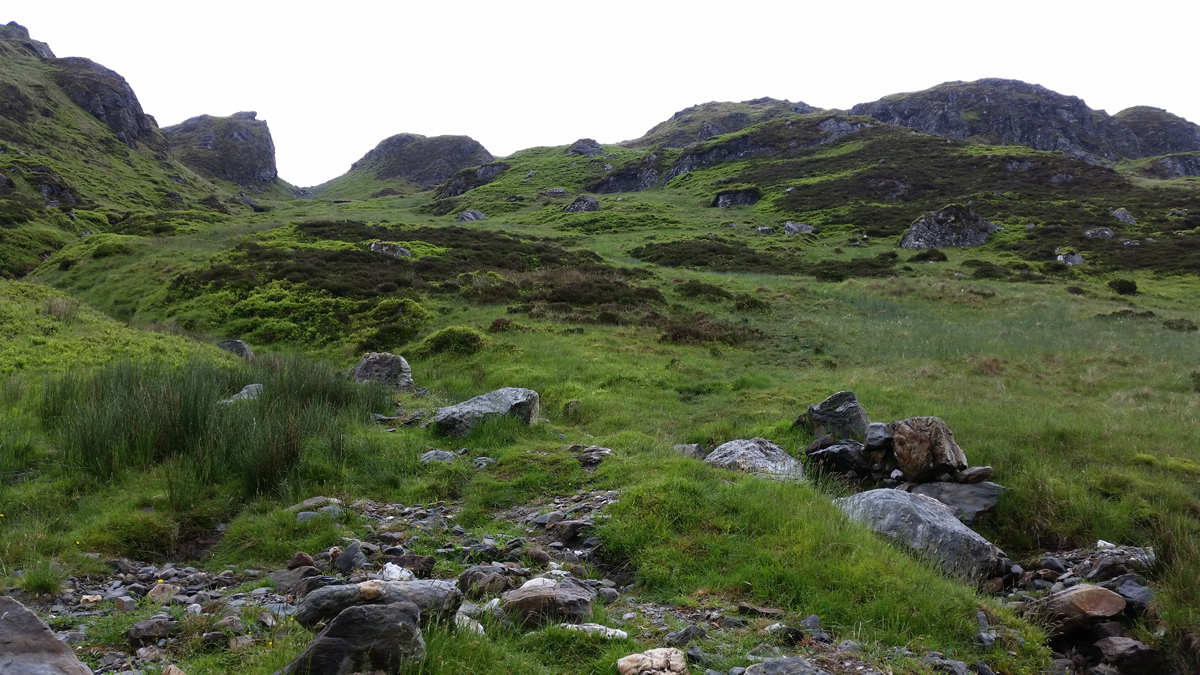
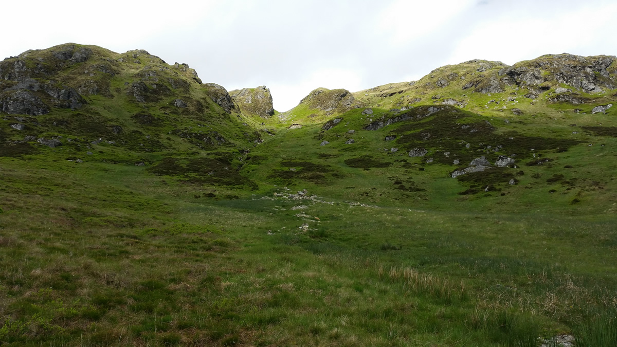
With cloud still covering the ridgeline, we set off from the lochan for the climb up the broad gully leading to Meall Nan Tarmachan, a fine minor top at 719m, where the path skirts below the top, and so, it remains mainly untrodden, as climbers bypass it at the 700m height and start the jewel in the crown of this fine ridge, the main ridgeline.
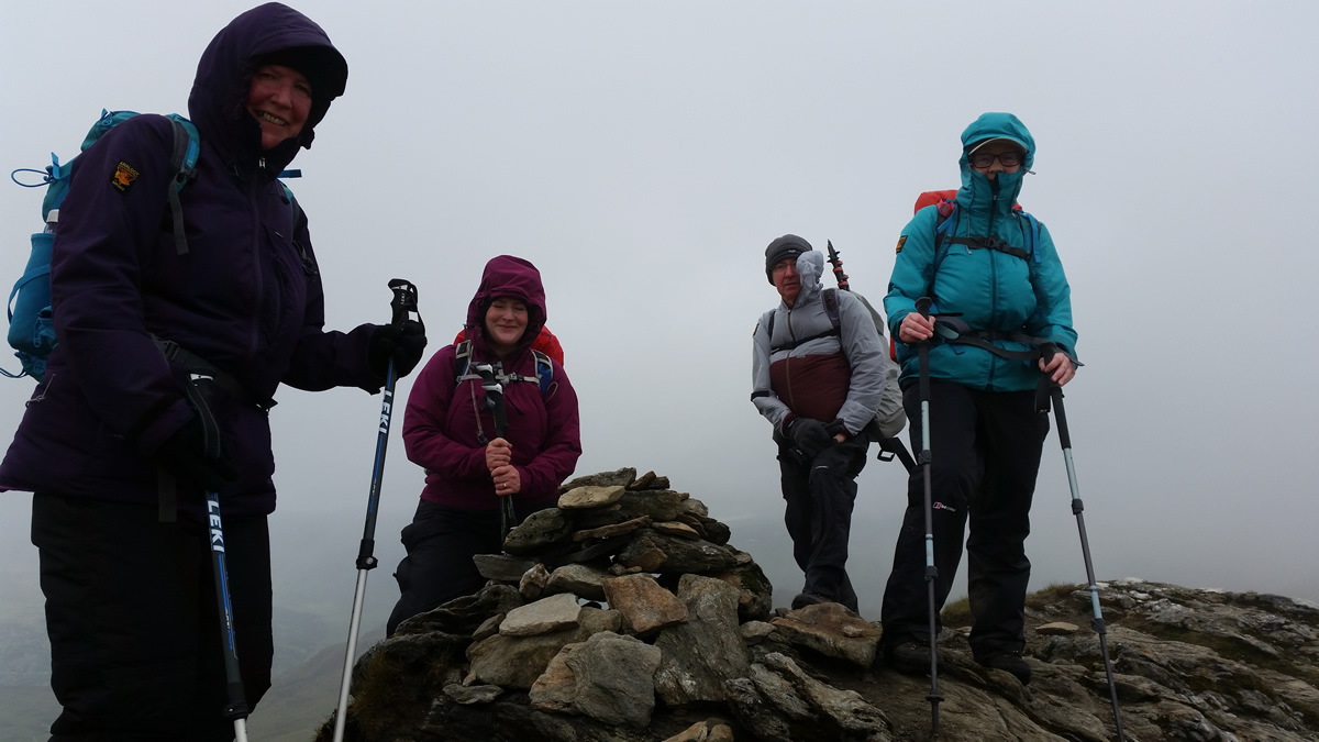
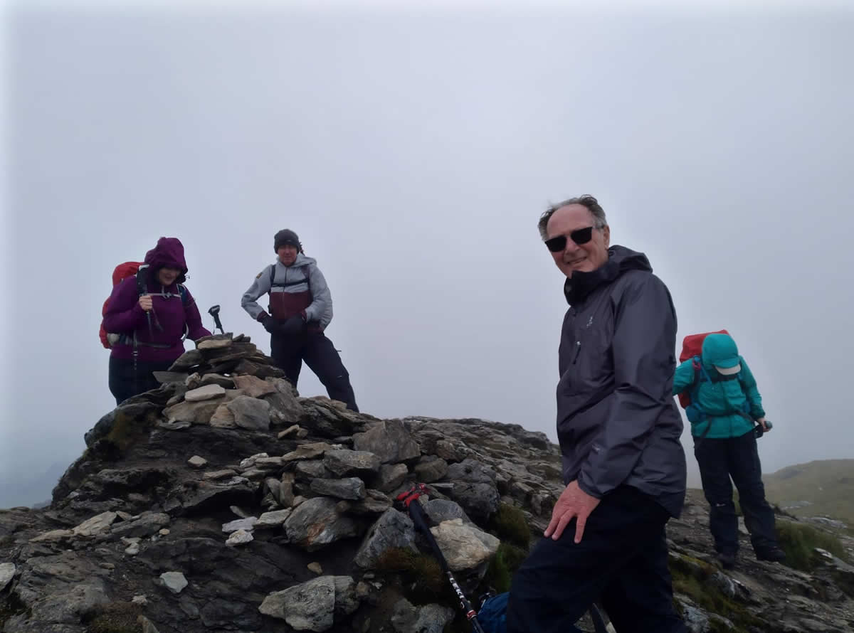
Unlike it's near neighbour, An Caisteal, where the ridgeline rises ahead of you into the distance, with little deviation of a direct path to the summit, the ridgeline of Beinn Chabhair keeps the first time ascender guessing as to what lies ahead. Each sharp, and twisting ascent, is invariably followed by a short sharp twisting descent, before yet another twisting ascent, the view ahead is only of the immediate obstacle, the summit remaining stubbornly hidden, apart from a few brief glimpses, weather permitting, if you know where to raise your eyes and look to the distance. Today, it remained hidden, the cloud refusing to budge, even in the ever increasing wind we encountered as we gained height along the ridge. And. by all accounts the worst was yet to come. It was quite a busy mountain, others we had seen ahead of us during the morning, were now making the descent, and all were clad in heavy outers, a few sporting hats and gloves, and all warning us that it was very windy and cold on the summit. And so it transpired, it was windy and cold, although not quite equalling the conditions of our memorable day in June 2017, now that was windy! Today however, we did remain on the summit, huddled below a grassy knoll, out of the main wind and had ourselves that well earned break. The views however, were not quite as stunning as expected, the low cloud covering most mountain tops, or maybe drifting to give a short spell of clarity before closing in once again to obscure the views.
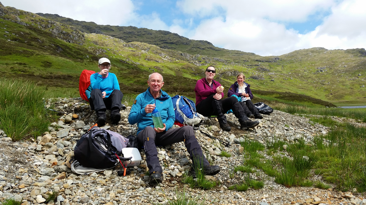
The ridge path is a delight to ascend, maybe not so for the descent, and so we made for a circular descent by heading off the summit down the southern ridge. Directly south of the summit, and some 200 metres distance there are two lochans, a relatively small one and another somewhat larger one which sits just below a craggy outcrop. Neither of these lochans are shown on the OS 50,000 or OS 25,000 scale maps, they are however shown on Harveys Superwalker 25,000 maps. The significant point about them, besides being a good navigation aid in poor visibility, is that they are directly on the watershed, the outflow from the smaller lochan flowing north northeast, while the outflow from the larger flows south southwest. Skirting the crags, we headed from the smaller lochan down a grassy gully to pick up the outflow from the larger lochan and follow this down easy slopes towards the minor bealach at 720m just to the east of the 742m top of Creag Bhreac Mhor. At the bealach, the gully and outflow eventually swings south east, at which point we crossed the bealach heading north west on a straight forward descent, still on grass and heather back to Lochan Beinn Chabhair, where a pebbled area on the shore offered an ideal spot for yet another break, and, at last the chance to remove our waterproofs as the drizzle had finally stopped and the sun was beginning to shine through the broken cloud.
The return from the lochan to Beinglas was uneventful, albeit, that last descent, back down the rocky path to the campsite is undoubtedly a sting in the tail at the end of a great day on a fabulous mountain.
Thanks everyone, amazing company.
Beinn Chabhair - Photo Gallery
Click any photo to activate large screen photo gallery