Beinn Trilleachan(839m)
Wednesday 8th August 2012
14kms
8hrs 30mins
As we drove through Crianlarich the early morning sunshine held the promise of clear skies and sunshine for our third visit in as many weeks to Glen Etive. And so it proved to be, albeit, for the first 2 hours or so the glen, loch and surrounding hills were shrouded in a thick early morning mist that just hung over everything.
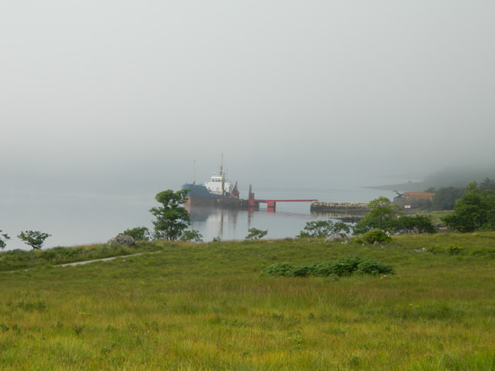
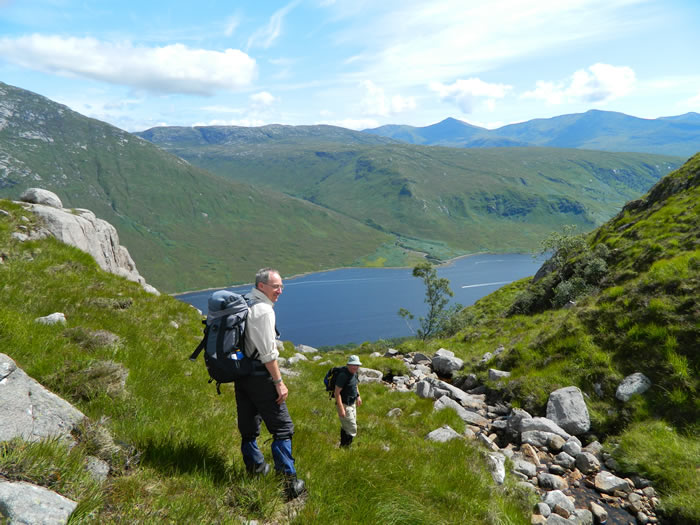
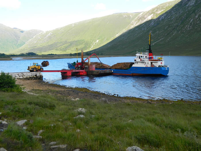
We parked up at the end of the single track road at the head of Loch Etive, and probably made the quickest transition ever from arrival to booted up and departure, due entirely to the hordes of midges that descended upon us the minute we got out of the car. I think we almost ran away from the car park hoping to leave the little blighters behind, but no such luck, they followed us every step of the way for the first hour or so, until we eventually started to get a little higher and pick up the breeze which had the duel effect of ridding us of the midges, and also blowing away the early morning mist.
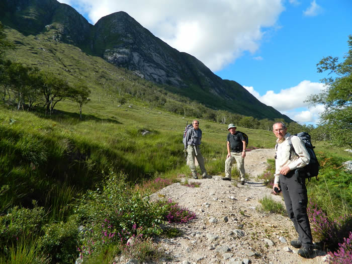
For our ascent, we planned to take the standard route via the forest boundary and then onto the shoulder of Meal nan Gobhar, over the minor top directly above the Trilleachan Slabs at 767m height followed by a steep descent into the bealach, and finally onto the summit of Beinn Trilleachan.
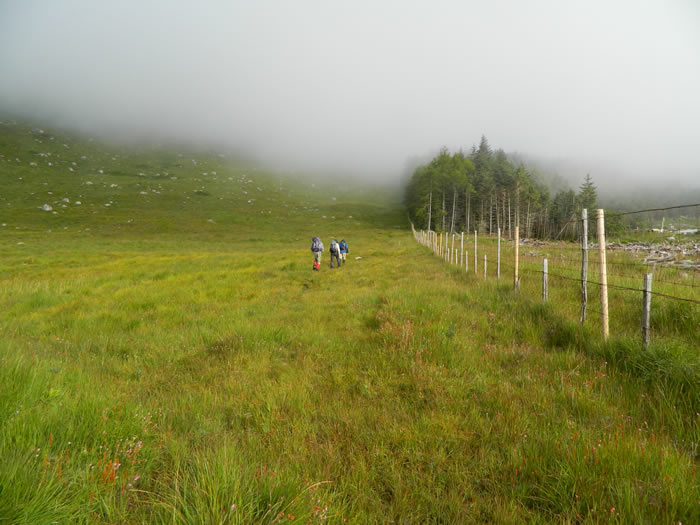
Right from the off, this is pretty much a pathless route, any resemblance of a path being very sporadic and barely worthy of the name. Following the fenceline along the forest boundary, the grass was knee high and ferns chest height at times. The going underfoot is extremely uneven, and it was not unusual to find the ground disappearing beneath your boot and going knee deep into a hole of some sort or another, mainly wet ones.
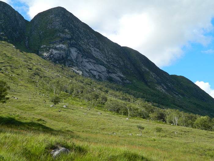
After about 1.5kms, we turned southwest away from the fenceline, and headed directly uphill towards Meal nan Gobhar. At this point, the day started to get better, the mist was rising, the midges not so troublesome, and the ground underfoot became more grass and rock slabs. However, the gradient became quite steep, with some short rocky sections to overcome.
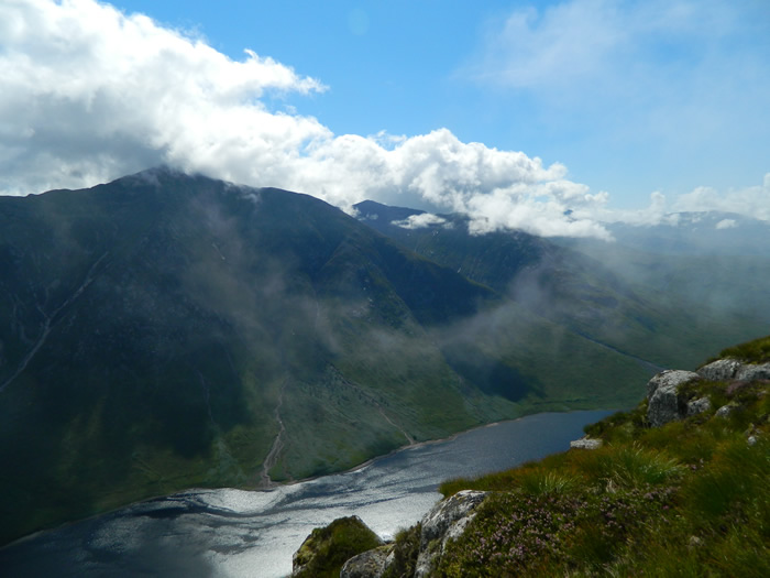
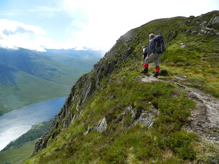
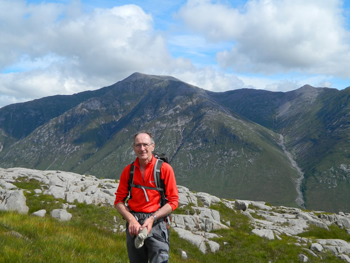
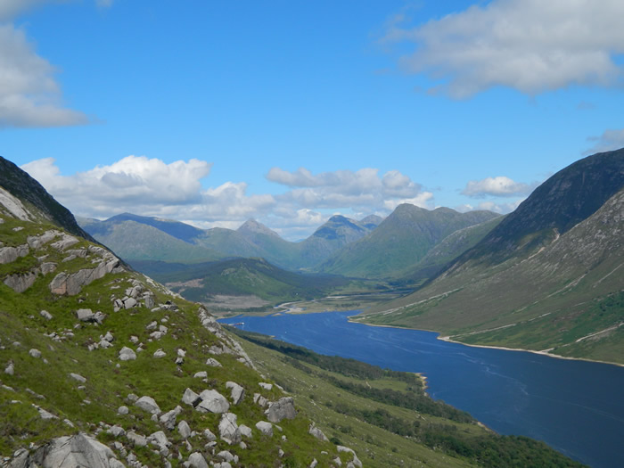
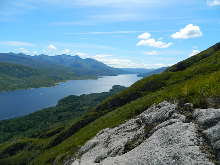
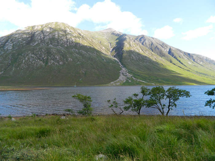
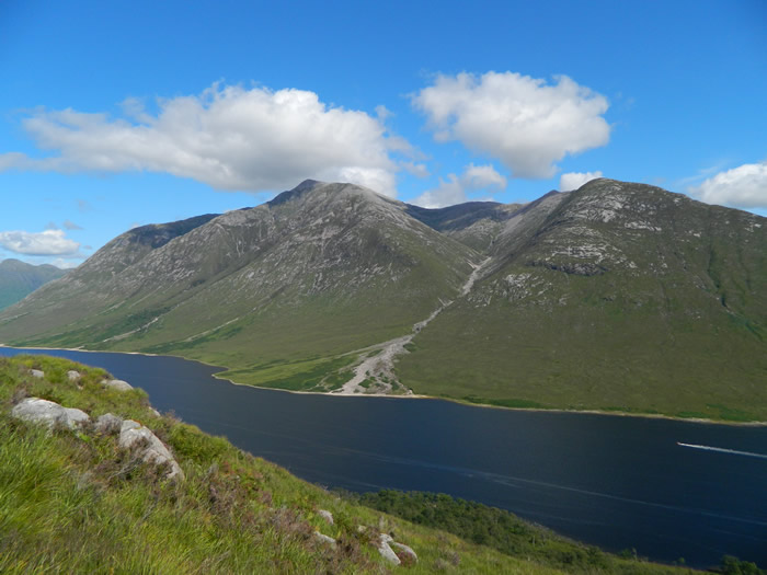
By the time we were topping Meal nan Gobhar we were presented with brilliant views of Loch Etive and the mighty Ben Starav on the opposite shore. Once on the ridge line, the going eases considerably, and a path emerges that leads you onwards towards the high point at 767m, directly overhead the Trilleachan Slabs. Standing on the edge of the path anywhere along the ridge line at this point, presents you with wonderful views down to the shoreline of Loch Etive, 767m below.
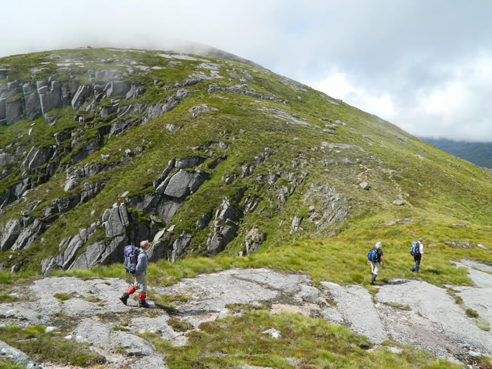
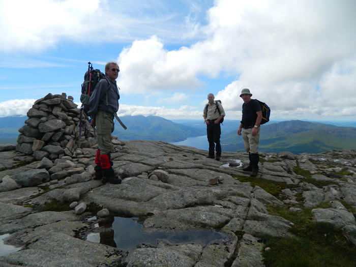
Departing the 767m high point involves a descent of approximately 70m down a layer of rock slabs which require some care. On a day such as we had, there is no real problem, as you can pick the best route down. However, in poor visibility, it may be more prudent to detour west for a 100 metres or so before turning south to pick up the ridge once more. From the bealach, the open ridge rises steadily towards the summit cairn, which finally comes into view as you crest a small stony ridge. It seems rather a large cairn by comparison to some on mightier tops.
The recognized return route for this mountain, is to retrace your outbound route, never an option that Alan subscribes to. Two weeks previously as we were on the northwest ridge of Ben Starav and studying Beinn Trilleachan from afar, we had discussed the possibility of continuing southwest beyond the summit and descending one of the many gullies to meet the path along the shoreline of Loch Etive and hence returning to the car park via this low level path.
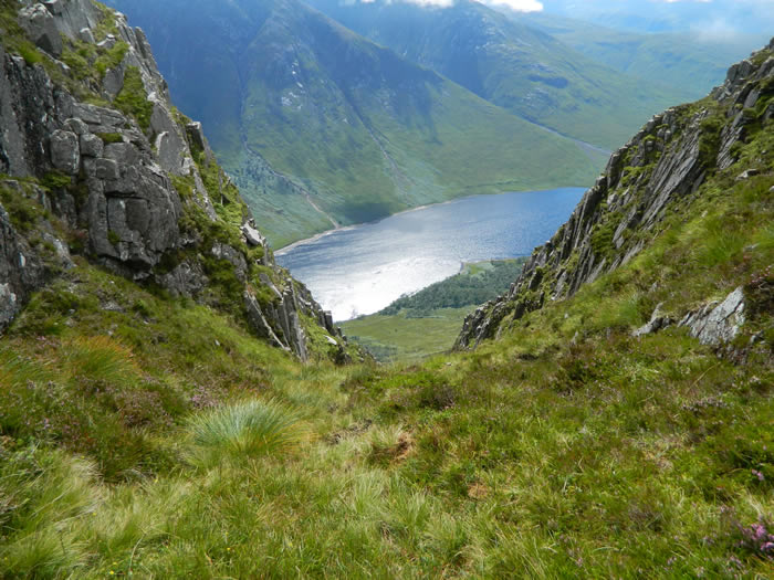
And so be it. We left the summit cairn heading generally southwest before swinging more south-southwest to Eas nan Cabar, before swinging southwest again till we were at the head of the gully running parallel to Teanga Dhubh. At which point we decided, this is the one. we can get down here okay!
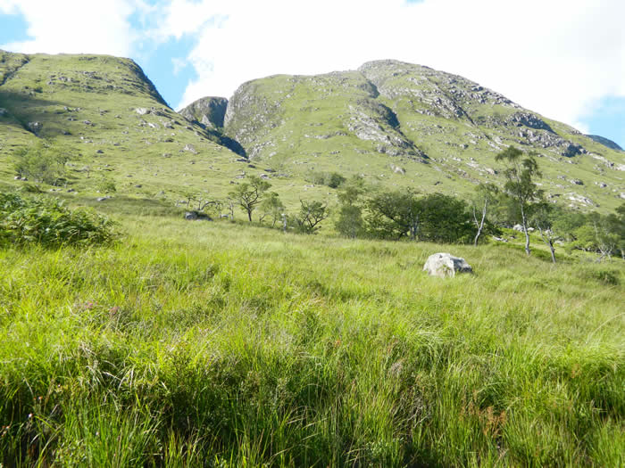
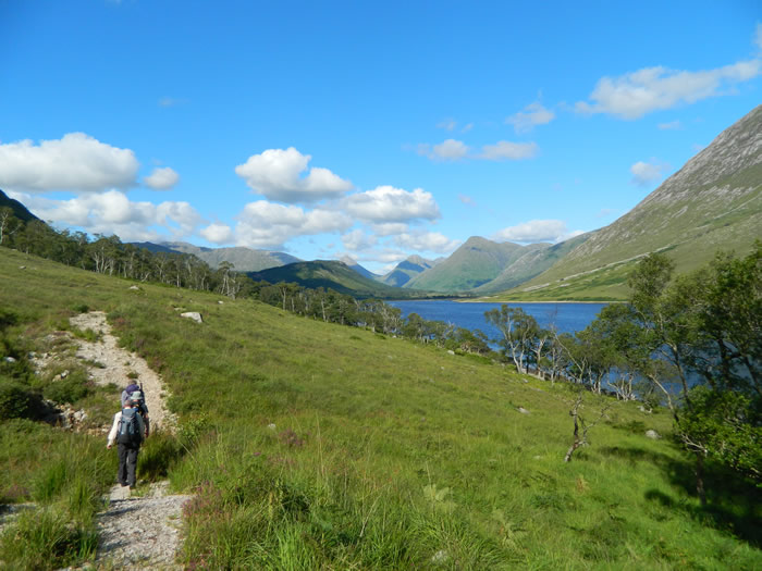
The descent was steep, and slow going, but the views on either side of us along the length of Loch Etive and over Ben Starav were spectacular, so why hurry. We eventually reached the old forest which lines the shores of Loch Etive at this point, and passed through this, with some difficulty as once again the ferns were chest and head height, to gain the shore path.
A longish, 5km walk back along the shoreline delivered us back to the car park, and thankfully a midge free change of footwear etc, before we made the journey back along the A82, with of course a watering stop, this time at the Bridge of Orchy hotel.
A great day, and great summit - Thanks Alan
Beinn Trilleachan - Photo Gallery
Click any photo to activate large screen photo gallery