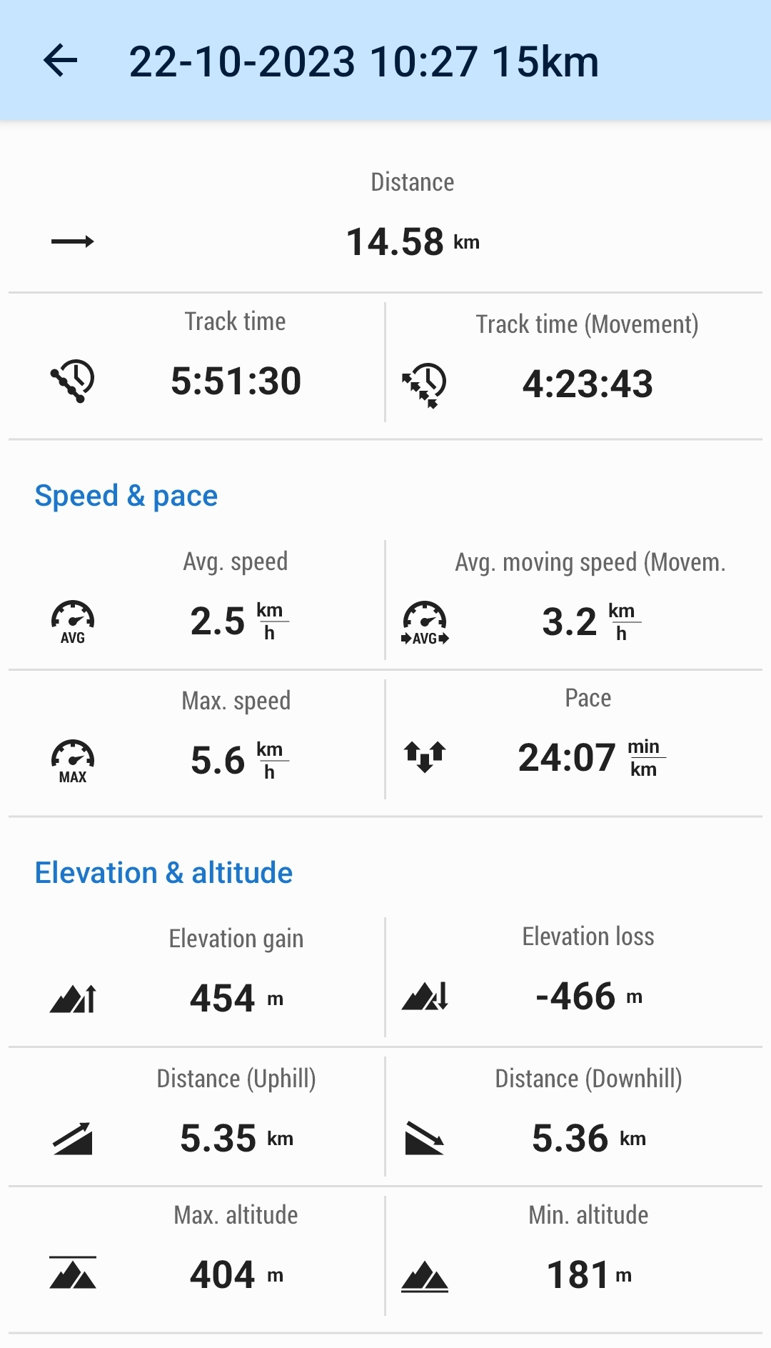
The Whangie and Duncolm(404m)
Sunday 22nd October 2023
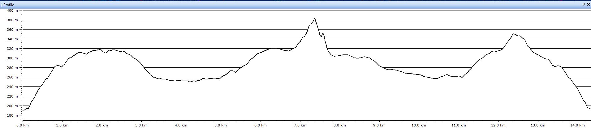
15kms
5hrs 45mins
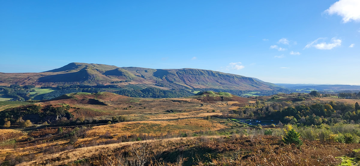
Storm Babet blew in early and mid-week and battered the east coast and areas north, thankfully however, we in the west were less affected with much lighter winds and significantly less rainfall. Nevertheless, it was still surprising to see the weekend turn out to be a beautiful autumnal couple of days with clear blue skies and a crisp chill to the mornings. All the more welcome for our Sunday walk to The Whangie and Duncolm, two popular destinations in the Kilpatrick Hills.
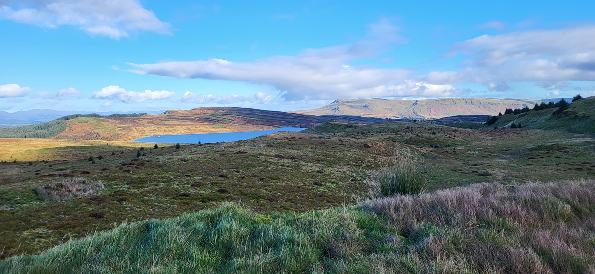
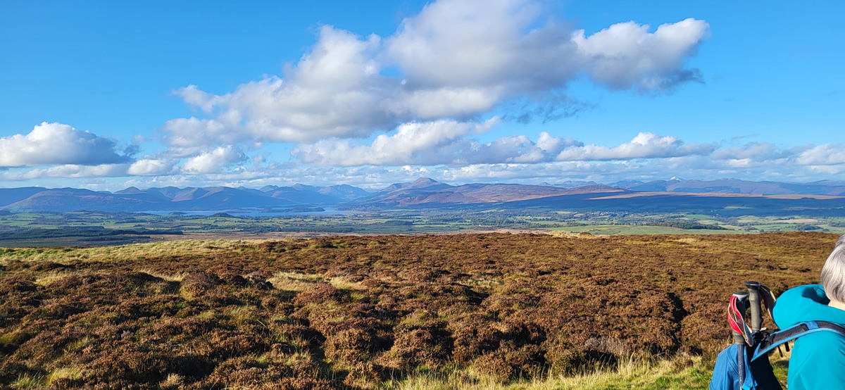
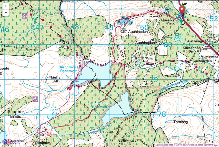
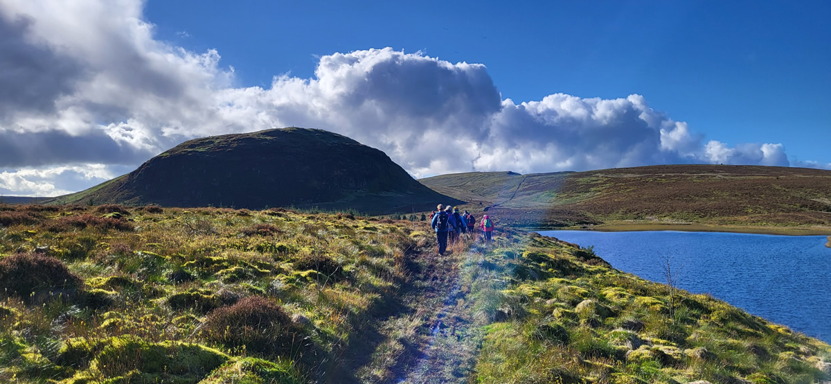
We departed Queens View car park and headed west along the northern slopes of Auchineden Hill on the well worn rocky path which climbs gradually up the hillside towards the geological feature of The Whangie. Immediately we started to gain height the views north opened up with shades of autumn colours lighting up the hillsides, already it was a good day.
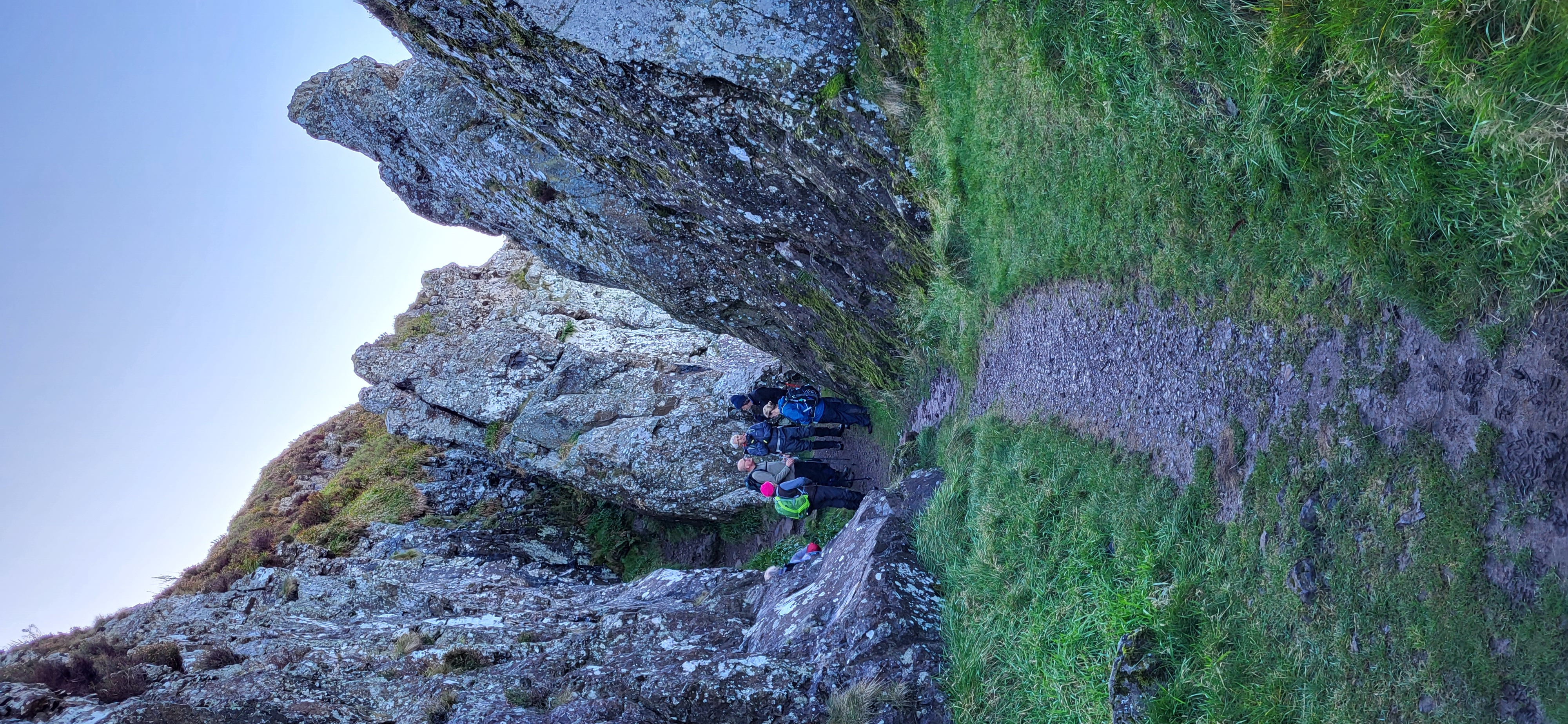
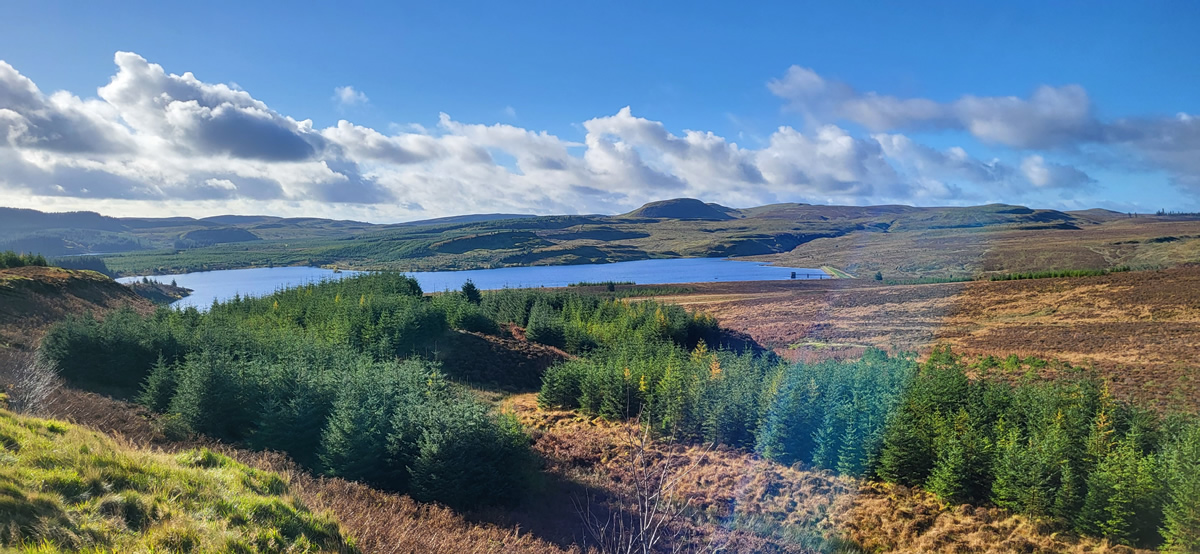
The Whangie is simply a split in the cliff face leaving a narrow passageway of about 100 metres long with the walls reaching some 12 metres in height along the length of the cleft and is probably the result of the early ice age fracturing the rocks, although local legend would have you believe that it is in fact the result of the devil swinging his tail and slicing the rock open; whichever, it is quite a spectacular sight on approach and an interesting little scramble through the gap. Beyond The Whangie we left the rocky path behind and trod a more wet and boggy path through the heather to descend towards the Burncrooks Reservoir for a short break in the late morning sunshine alongside the dam.
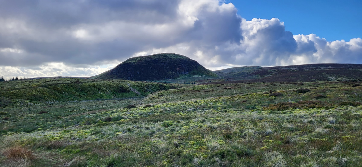
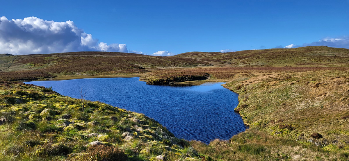
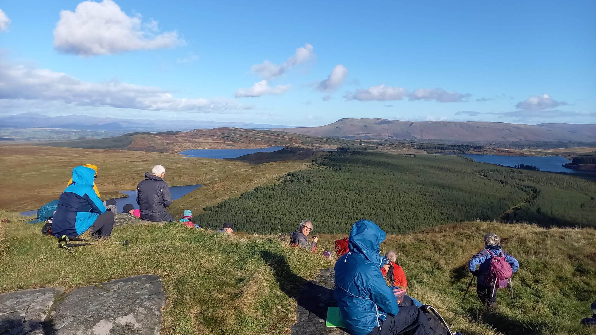
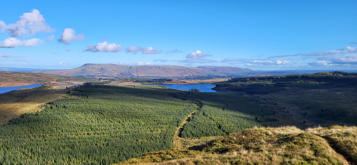
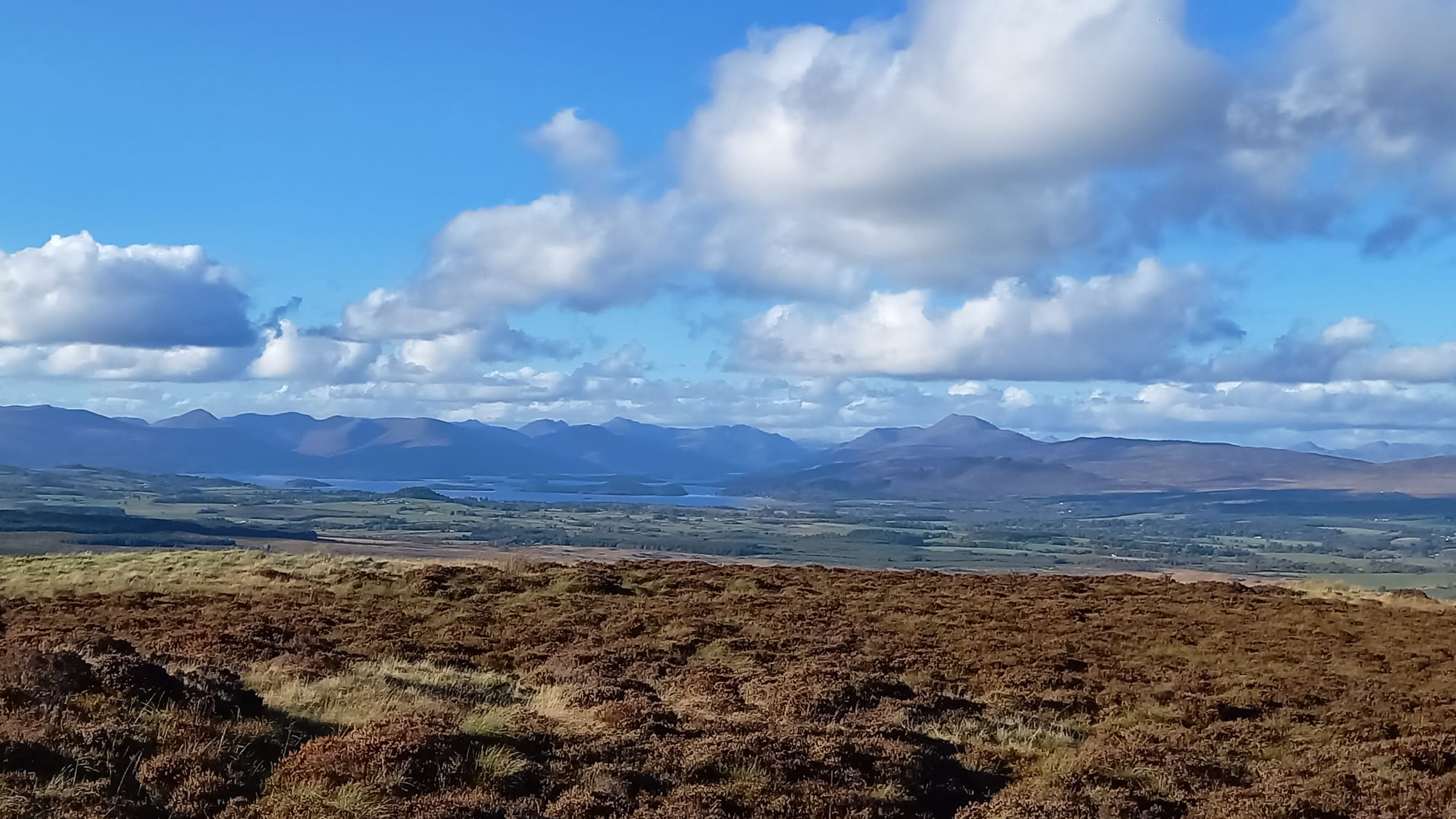
Crossing the dam we followed the footpath which circumnavigates the reservoir, and shortly after crossing the Burn Crooks burn and a short climb up the path we stopped by the small cairn which marks the spot for those heading for Duncolm to leave the fine footpath and take to the less defined and quite wet and boggy track across the open moorland towards Lily Loch and the lower slopes on the western side of Duncolm. Another short, but slightly steeper climb up the hillside and we were rewarded with a fantastic viewpoint from the 401m, Trip Point on the summit of Duncolm. A fantastic viewpoint for a fairly long and relaxed lunch break. The day was just getting better, wonderful.
The trudge across the moorland was quite wet underfoot, and the plan was to return back across the same route to rejoin the good footpath and complete the circumnavigation around the reservoir. This being my first visit to Duncolm, prior to joining the walk I had carried out some research and map gazing during which I noticed that there was an alternative return route directly through the forest to the northeast of Duncolm, via a firebreak and forest track, confirmed by a few references I found of others taking a similar route. A discussion with Peter, the walk leader resulted in the group splitting, whereby six of us would leave the main group and carry out a recce through the forest to confirm or otherwise the existence of an alternative, and hopefully dryer return route.
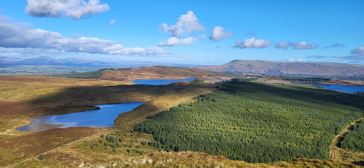
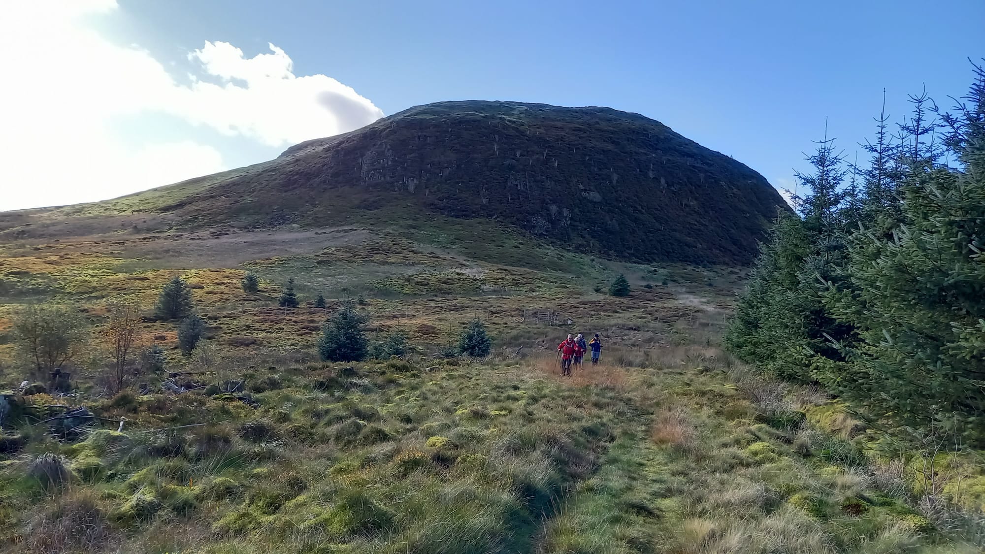
Making the descent northeast off the summit of Duncolm was the first challenge, as there is an arc of sheer crags running from north through to east of the summit. We initially headed east on a narrow, but clear path which petered out directly above the crags. However, a short contour around the top of the crags and it was quite easy to descend down the slope to gain a rough track through the grasses which headed directly to a fine ladder stile over the high gate and deer fence surrounding the forest. A ladder stile, that was encouraging as their purpose is generally to allow walkers to pass by, which generally means a path of some sorts exists. And so it transpired, over the stile we had approximately 750 metres of firebrake to negotiate on a faint path, wet at times, but very easy going, and at the end of which was a fully constructed forest track, with wide open views as the forest was in it’s infancy. An easy 2½ kms later we were at the base of the path up to Auchineden Hill and yet another superb viewpoint from it’s 357m Trig Point and summit.
Ending the day, we took the short moorland track from the summit of Auchineden to rejoin the descent path from The Whangie for our return to Queen View car park.
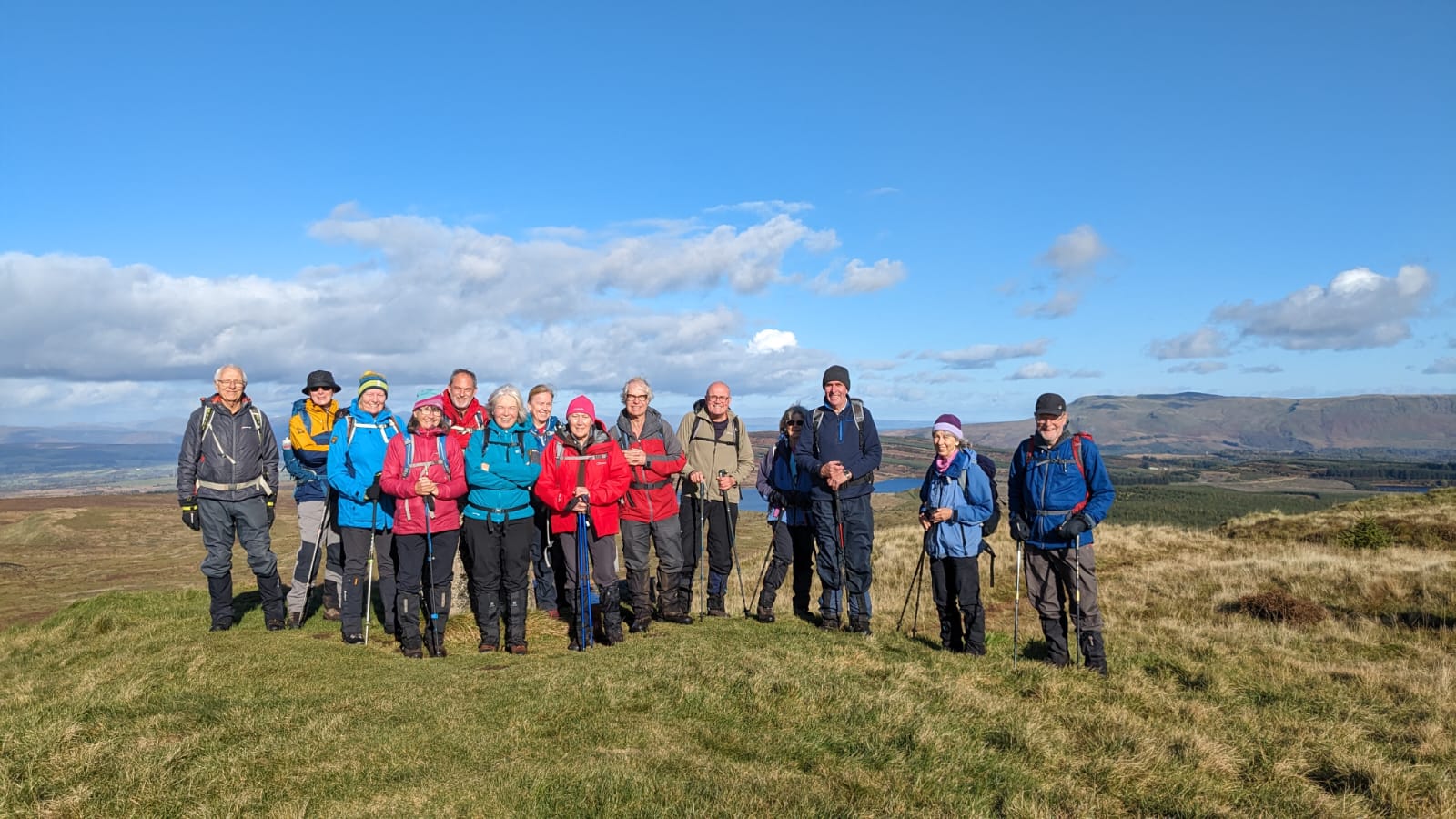
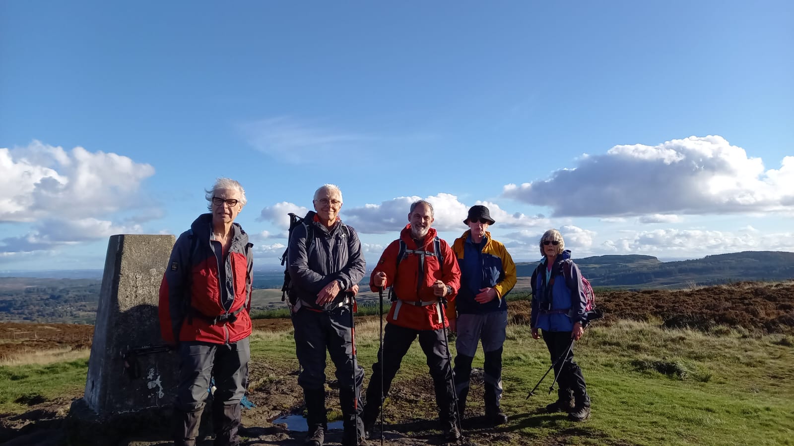
A brilliant day, thanks Peter, and everyone for your company.
Photo Gallery
Click the buttons to select photo size.