Geal Charn Mor(824m)
Sunday 1st October 2017
11kms
4hrs

Sunday and day two of our weekend at Newtonmore and the weather forecast was not good; a Yellow Warning was in force for heavy rain and winds of 40mph plus with gusts of 55mph plus. So breakfast was decision time, with the majority electing for a relaxed day at the Pitlochry Hydro Visitors Centre, while 6 of us opted for what is arguably the easiest Corbett of them all, Geal Charn Mor. Easy because the "Burma Road" rises to the 700m bealach, leaving a final ascent of a mere 124m over 1.3k of open moorland to reach the summit; surely that must be possible even in heavy rain and strong winds?
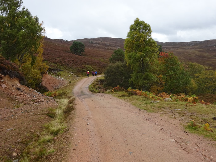
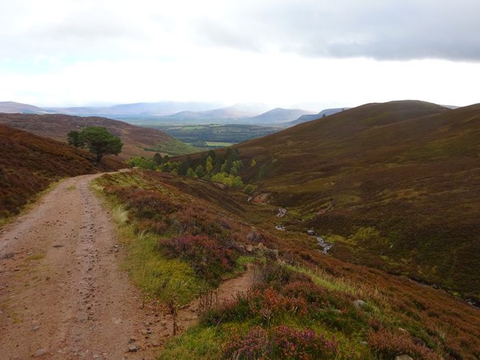
We parked at Alltnacriche at the eastern end of the Burma Road, a fine graded single track mountain road, built by POWs during the 1940s, which traverses the southern ridges of the Monadhliath Mountains from Lynwilg, just outside Aviemore and links via the River Dulnain to Carrbridge. The rain was persistent, but not too heavy, and the wind strong but manageable as we contoured the hillside on the gently winding road on a steady climb from Alltnacriche towards the 700m bealach between Geal Charn Mor and Geal Charn Beag. All was fine until we reached an altitude of about 600m where the road exits the An Gleannan and reaches a more open area of moorland, and that's when we began to feel the real effect of the wind as it hit us with considerable force, making the final stretch to the high bealach at 700m a bit of a battle.
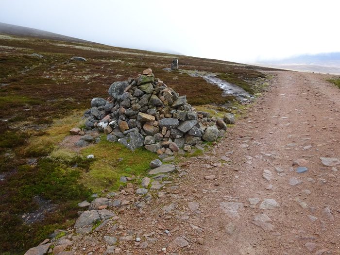
From the marker cairns we left the road and headed onto a rough track, a mixture of short stretches of boggy heather, and more substantial rock base, and, as we ascended the easy slopes of this broad moorland, the battle against wind and rain intensified; we had now entered the cloud base with visibility reduced to a few metres and the temperature dropped such that the rain felt like an icy blast against our faces.
It was with some relief that we arrived at the Trig Pt and wind shelter marking the summit of this 824m Corbett, and, after the briefest of stops to get that all important summit photo, one only, we did not even hang around to swap places and add my mug-shot to the group, we turned around, and, to Alan's dismay headed right back down to the slightly more manageable winds to be had along the more sheltered confines of the Burma Road.
I said at the start of this report that Geal Charn Mor is arguably the easiest Corbett, and that may be so, but even the easiest of climbs can be a challenge under poor weather conditions, and I think we were all quite pleased with our days achievement in challenging conditions.
Anyway, an early return from the hills can be beneficial, especially if it leaves time on the drive home to call in at the Taste Perthshire Visitors Centre at Bankfoot and, even if it is 4pm, to indulge in an All-Day Scottish Breakfast including Haggis and mushrooms, plenty of toast, and probably the best cup of tea you will get in any restaurant. Scrumptious!
Great day, Brilliant weekend - Thanks everyone for your company, both on the hills and for some stimulating and interesting chat in the evenings!
Geal Charn Mor - Photo Gallery
Click any photo to activate large screen photo gallery